Saturday, May 11, 2013

May 11, 2013 Mt Baker

Having climbed Mt St Helens the previous weekend in beautiful weather, Nicole and I figured another volcano ought to be on the list if the weather was good. The high pressure ridge hung around for most of the week, but showed signs of deteriorating on Sunday, so we decided to head into camp below Heliotrope ridge on Friday afternoon and climb on Saturday.


We were able to drive just past Lookout creek, and if we were a bit more bold with the Subaru, probably could have gotten over that patch of snow and up the road another mile. Having plenty of time, however, we opted to park it and walk/skin the ~2 miles to the trailhead. I realized I left my glacier glasses in the car after walking uphill for 15 minutes... nothing a short barefoot jog can't fix... Once at the summer trailhead I led us down to the stream and in a few minutes wandered about the trees until we found the bridge crossing the creek - newly replaced since last summer! We didn't learn until the next day that there is a much more straightforward approach for skiiers up the Grouse Creek drainage.
Baker Approach from Erik Turner on Vimeo.

Some friendly Canadians took a self portrait not knowing I was juuuust about winding the bend. If you see these characters  take their camera and shoot something weird with it...

Up the summer trail we went - flanked by a gregarious solo BC dude ahead of us, and trailed by the group of 5 wanna be photographer BCers. The trail was fairly annonying for the most part - skis on and off several times, handful of sketchy creek crossings, but eventually as we got up towards Kulshan creek it started to open up.


Baker - approach 2 from Erik Turner on Vimeo.

Baker Approach from Erik Turner on Vimeo.

We crossed Kulshan, our last crossing, and headed up the ridge line and started to break out of the trees as low angle light started to filter through the clouds.


evening light as we neared camp
I pushed Nicole to go a bit further a few times so that we'd have a good view of the mountain from camp. I had an eye for getting another time lapse and wanted to frame the mountain with stars trailing around in the background. As the sun slowly slipped down past the forested ridges behind us, some beautiful light hit the clouds up above Baker.

View from camp. We climbed a bit behind the right skyline. Left skyline is North ridge

Evening light getting good!

glacier folds and beautiful clouds... wonderful backdrop to have dinner in front of...
The timelapse turned out quite well - It was my first time using Magic Lantern to trigger the shots in camera, and also the first time I've used LRTimelapse, which is an amazing program that makes assembling a timelapse much easier.

Koma Kulshan stars from Erik Turner on Vimeo.


We ran out of fuel while melting snow for water for the next day, and had to get by with about 2 liters each. I normally wouldn't have wanted to carry much more, but I would have taken the stove with fuel up and made more water somewhere along the route. Fortunately the morning was just cloudy enough to keep it cool, and we were able to get by with the water we had.


morning light
Climbing conditions were perfect as we skinned up the lower Coleman - pausing at around 7000' to rope up before continuing up along the standard route close to the Black Buttes. We enjoyed gorgeous views of the glacier and the route above, put to scale by the 5 Canadians in front of us.

rounding about the first steep step on the lower Coleman before roping up

Crevasses far below on the lower Coleman

can you see the climbers?

Climbers above a series of seracs

Baker and Colfax

Nicole leading the way up towards the saddle

impressive crevasses looking up towards Colfax from just below the 9000' saddle.

We arrived at the saddle with plenty of time before our turn around, so all was looking good. A quick rest and some refueling, and we were booting it up the steep section just around the corner from the Roman wall. Some topos label the Roman wall as what this route climbs, and some label it as the Coleman headwall - regardless, we climbed right up between the two rimy rock bands you can clearly see once you swing onto the Deming.


Looking across the Deming glacier towards Glacier Peak


The masses are coming!

Lenticulars forming downstream of the summit.... it's gonna get windy!

Nicole approaching the summit

top of the world!
We enjoyed some beautiful summit views, which were cut short by the strong winds that were whipping up pretty strongly. I didn't even scope out the drop down onto the Park headwall, or the route out towards the ski area - routes I'd like to do sometime - oh well. I'll just have to climb N. Ridge to get a view then!

The ski out was fantastic... very doable up high with soft enough snow to turn right at the top of the Roman Wall. And even as it got heavy on the way down, it still skiied very well, with easy carving conditions all the way out the Grouse Creek drainage.

Skiing is so much fun!

Packing up camp... tent almost got away!?
I skiied down a bit extra to retrieve camp - not knowing where the winter route was the night before we had set up camp too low. I packed my 38L with about 50L worth of junk and brought it back up to the ridge and met up with Nicole for the easy traverse and ski out via Grouse Creek.

Beautiful cloud formations in the afternoon light

Nicole starting the traverse over towards the winter route

A beautiful day out in the mountains, and I think an excellent way to begin our summer climbing schedule of having half days off on Friday! Having that extra half day makes so many more trips either possible or just more enjoyable. Next up on the list are Glacier, Olympus, Rainier.... some of those perhaps taking a bit more than the 2.5 day "weekends" we've been enjoying...

Friday, April 26, 2013

April 26, 2013 - Cave ridge bivy

Having failed to get out into the mountains in the high pressure weather that dominated the entire work week, I was motivated to get out on Friday evening to photograph the night and take in a little alpine splendor before strong systems moved in on Saturday and Sunday. Ambitious plans for Rainier and Stuart quickly faded away when weather and NWAC forecasts suggested a mellower trip. Realizing it was also a full moon, I decided to climb Snoqualmie Mtn via Cave ridge - a fairly straight forward and easy route which would allow me to climb by the moonlight and drink in views of the Snoqualmie area before the winter's coat began to melt off in earnest.

Work commitments, a slow packing job and an acrobatic cat who wanted one more run around the house kept me from leaving town too early. It was past 9pm when I finally sauntered across I-90 and headed into the woods. Last year on Grante Mountain when I went solo the feeling of walking into the trees wasn't quite so spooky, as the trailhead is already a bit removed from the highway, and you already feel like you've started your trip. This time, however, I felt very aware of my actions as I stepped through the dense guard of pine trees which were ringed by deep spring tree wells. Despite the highway noise the utter darkness and muffled sounds in thick trees led me to believe I was already in the middle of nowhere. I tracked up the PCT until I found the typical creek crossing, which would have required a 2' down climb of vertical snow, crossing a decently narrow bridge, and a 2' overhanging snow bouldering problem. I thought seriously about doing it, as the challenge would have been fun, but thankfully quick overcame the impuse and scooted along on the SE side of the creek.

Not too far up valley another mellower crossing was available, as the snowshoe herd track suggested, and I was off up Commonwealth. Up to this point I haven't not gotten lost in Commonwealth Basin, in the day light. Yet I felt I had learned my lesson and navigating in the pitch black would be possible. To be fair, light doesn't help much, because for much of the way you can't see very far anyway. I finally got a glimpse of Red, which really highlighted just how far the melt had already reach, as half the face was already bare rock. The views quickly vanished again into the trees and I made my way across the drainage and up towards Cave ridge.

Red Mtn in the darkness

My navigation was certainly not perfect, and I did enter the cave ridge drainage a bit further North than planned, which exposed me to a few steep slopes beneath cliff bands - I quickly shot down to the treed mellow slopes beneath them and cut my way further south and up the mellow treed side of the drainage. I eventually found a skintrack coming in from my left and followed it all the way up to the saddle between Guye and Cave Ridge proper. It was a remarkable experience to gaze back at Guye Peak and realize how much of a fin it really is. From the highway Guye showcases its massive SW face which leads one to believe it to be a mountain of substantial bulk, but looking down at Guye from the slopes above the saddle revealed the thin slender side I had never seen before. I entertained the thought of walking up Guye instead, as it was clearly much closer than the summit of Snoqualmie - but my original plans still enticed me up the ridge.

Guye peak and a rising full moon

The skin track had ended and I followed mellow slopes in and out of trees up towards the last climb to gain the named feature along the ridge. It was on a traverse NW across a steep slope to gain a mellower approach to the last climb that I stopped dead in my tracks and knew my plans had changed. Chair peak shone brightly, reflecting the strong full moon that had now illuminated the landscape. Other Alpental valley peaks spread out around this lofty peak. The frosting, however, was the light pollution behind the peaks reflecting from civilization off to the west. Beautiful hues of orange blended into grey cloud which blended back into dark blue with stars topping it off. I quickly got out of the immediate, though mellow, avy path, and set up the tripod.

Already worth the trip.
finishing the climb up to Cave Ridge

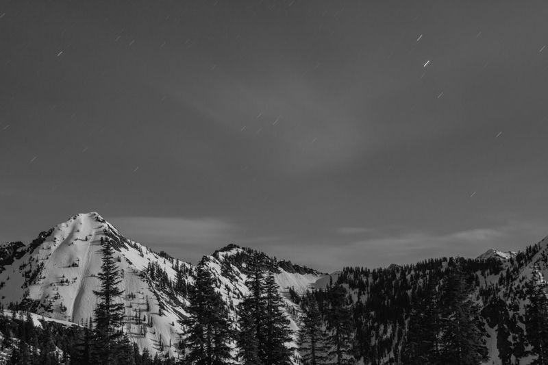
It was a good hour or so before I finally convinced myself to finish the climb up to Cave Ridge, where I officially ended my climb for Snoqualmie Mtn and instead took pictures until 3AM. I learned the very valuable lesson that even a tripod securely thrust into dense snow can be moved by 30mph gusts of wind. Most of my exposures came out disappointingly soft, and despite the difficulties of focusing at night, I believe the wind was the culprit. The star trails in the shots, which short, indicated that camera motion, and not soft focus, was usually to blame. It was interesting that despite the bright conditions, the only thing I could fix a focus on was the moon - not even the lit up ridgelines produced enough contrast.
Beautiful scenes


some snow still left on Red


I finally made my way to a wind shelter and a cozy place to lay down, which just meant I had to setup the tripod on top of the bivy to keep shooting towards Rainier and Silver. Soon enough, however, my creative juices slowed and my eyes got heavy. I packed up my gear and stuffed all in my pack, which quickly became my pillow. I passed out hard and didn't wake until the sky was quite bright, but thankfully the conditions were not there for good sunrise pictures, so I rolled over and caught another hour of sleep.

The ski down was straight forward once I picked my way down the horrendous trapper crust up high. Any motion resembling a turn would simply grab your skis and lock them in place, leaving the rest of your body to attempt the turn, pivoting around your knees....eeeehh yeah. I basically kick turned and stem christied my way down into the trees, where the soft snow allowed for mushy buttery turns. I followed the skintrack I found all the way out to the private ski tow area - a much better place to access objectives on this side of Commonwealth Creek - no crossing I90, and no creek crossings!


Rainier in the morning


Weather was obviously on its way in - time to head east!