Showing posts with label snoqualmie. Show all posts

Friday, April 26, 2013

April 26, 2013 - Cave ridge bivy

Having failed to get out into the mountains in the high pressure weather that dominated the entire work week, I was motivated to get out on Friday evening to photograph the night and take in a little alpine splendor before strong systems moved in on Saturday and Sunday. Ambitious plans for Rainier and Stuart quickly faded away when weather and NWAC forecasts suggested a mellower trip. Realizing it was also a full moon, I decided to climb Snoqualmie Mtn via Cave ridge - a fairly straight forward and easy route which would allow me to climb by the moonlight and drink in views of the Snoqualmie area before the winter's coat began to melt off in earnest.

Work commitments, a slow packing job and an acrobatic cat who wanted one more run around the house kept me from leaving town too early. It was past 9pm when I finally sauntered across I-90 and headed into the woods. Last year on Grante Mountain when I went solo the feeling of walking into the trees wasn't quite so spooky, as the trailhead is already a bit removed from the highway, and you already feel like you've started your trip. This time, however, I felt very aware of my actions as I stepped through the dense guard of pine trees which were ringed by deep spring tree wells. Despite the highway noise the utter darkness and muffled sounds in thick trees led me to believe I was already in the middle of nowhere. I tracked up the PCT until I found the typical creek crossing, which would have required a 2' down climb of vertical snow, crossing a decently narrow bridge, and a 2' overhanging snow bouldering problem. I thought seriously about doing it, as the challenge would have been fun, but thankfully quick overcame the impuse and scooted along on the SE side of the creek.

Not too far up valley another mellower crossing was available, as the snowshoe herd track suggested, and I was off up Commonwealth. Up to this point I haven't not gotten lost in Commonwealth Basin, in the day light. Yet I felt I had learned my lesson and navigating in the pitch black would be possible. To be fair, light doesn't help much, because for much of the way you can't see very far anyway. I finally got a glimpse of Red, which really highlighted just how far the melt had already reach, as half the face was already bare rock. The views quickly vanished again into the trees and I made my way across the drainage and up towards Cave ridge.

Red Mtn in the darkness

My navigation was certainly not perfect, and I did enter the cave ridge drainage a bit further North than planned, which exposed me to a few steep slopes beneath cliff bands - I quickly shot down to the treed mellow slopes beneath them and cut my way further south and up the mellow treed side of the drainage. I eventually found a skintrack coming in from my left and followed it all the way up to the saddle between Guye and Cave Ridge proper. It was a remarkable experience to gaze back at Guye Peak and realize how much of a fin it really is. From the highway Guye showcases its massive SW face which leads one to believe it to be a mountain of substantial bulk, but looking down at Guye from the slopes above the saddle revealed the thin slender side I had never seen before. I entertained the thought of walking up Guye instead, as it was clearly much closer than the summit of Snoqualmie - but my original plans still enticed me up the ridge.

Guye peak and a rising full moon

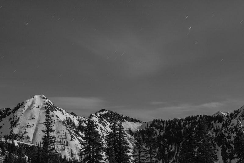
The skin track had ended and I followed mellow slopes in and out of trees up towards the last climb to gain the named feature along the ridge. It was on a traverse NW across a steep slope to gain a mellower approach to the last climb that I stopped dead in my tracks and knew my plans had changed. Chair peak shone brightly, reflecting the strong full moon that had now illuminated the landscape. Other Alpental valley peaks spread out around this lofty peak. The frosting, however, was the light pollution behind the peaks reflecting from civilization off to the west. Beautiful hues of orange blended into grey cloud which blended back into dark blue with stars topping it off. I quickly got out of the immediate, though mellow, avy path, and set up the tripod.

Already worth the trip.
finishing the climb up to Cave Ridge

It was a good hour or so before I finally convinced myself to finish the climb up to Cave Ridge, where I officially ended my climb for Snoqualmie Mtn and instead took pictures until 3AM. I learned the very valuable lesson that even a tripod securely thrust into dense snow can be moved by 30mph gusts of wind. Most of my exposures came out disappointingly soft, and despite the difficulties of focusing at night, I believe the wind was the culprit. The star trails in the shots, which short, indicated that camera motion, and not soft focus, was usually to blame. It was interesting that despite the bright conditions, the only thing I could fix a focus on was the moon - not even the lit up ridgelines produced enough contrast.
Beautiful scenes


some snow still left on Red


I finally made my way to a wind shelter and a cozy place to lay down, which just meant I had to setup the tripod on top of the bivy to keep shooting towards Rainier and Silver. Soon enough, however, my creative juices slowed and my eyes got heavy. I packed up my gear and stuffed all in my pack, which quickly became my pillow. I passed out hard and didn't wake until the sky was quite bright, but thankfully the conditions were not there for good sunrise pictures, so I rolled over and caught another hour of sleep.

The ski down was straight forward once I picked my way down the horrendous trapper crust up high. Any motion resembling a turn would simply grab your skis and lock them in place, leaving the rest of your body to attempt the turn, pivoting around your knees....eeeehh yeah. I basically kick turned and stem christied my way down into the trees, where the soft snow allowed for mushy buttery turns. I followed the skintrack I found all the way out to the private ski tow area - a much better place to access objectives on this side of Commonwealth Creek - no crossing I90, and no creek crossings!


Rainier in the morning


Weather was obviously on its way in - time to head east!

Saturday, March 30, 2013

March 30 2013 - Mt Thomson #1


Our route up Commonwealth, over Kendall Catwalk towards Thomson and out Gold Creek. A better exit sketched out going up Silver Creek and out to Commonwealth directly... next time!

Mt Thomson NE of Snoqualmie has been on the list ever since I saw pictures of it a few years ago. With a moderate 5.6 rating and amazing views into the depth of the Alpine Lakes Wilderness, it makes for an excellent climb.

Garrett and I hemmed and hawed for a while about the best approach for the climb, and finally landed on a single day push to move light and fast, unencumbered by overnight gear. We left the Commonwealth trailhead under wonderful weather at 5AM.

gearing up in the AM

The going was very easy in the tracked out path up Commonwealth, and for the first time we did not cross at the log bridge, but kept going up the south / east side of the creek up towards the NE corner of the drainage. Luckily a skin track was going just where we needed it all day long, not too uncommon in this area, but we didn't think we'd be so lucky! It was especially nice to have a flat platform skintrack on the switchbacks up towards the col shared by the PCT as it snakes past Kendall.


gorgeous moon setting

There are two snoqualmies. The moderate slopes facing the highway laced with lifts, and then there is the backside gnarliness. Snoqualmie seems to me a western town with a veneer of mellow slopes on the highway side and gnarly chutes just around the corner.

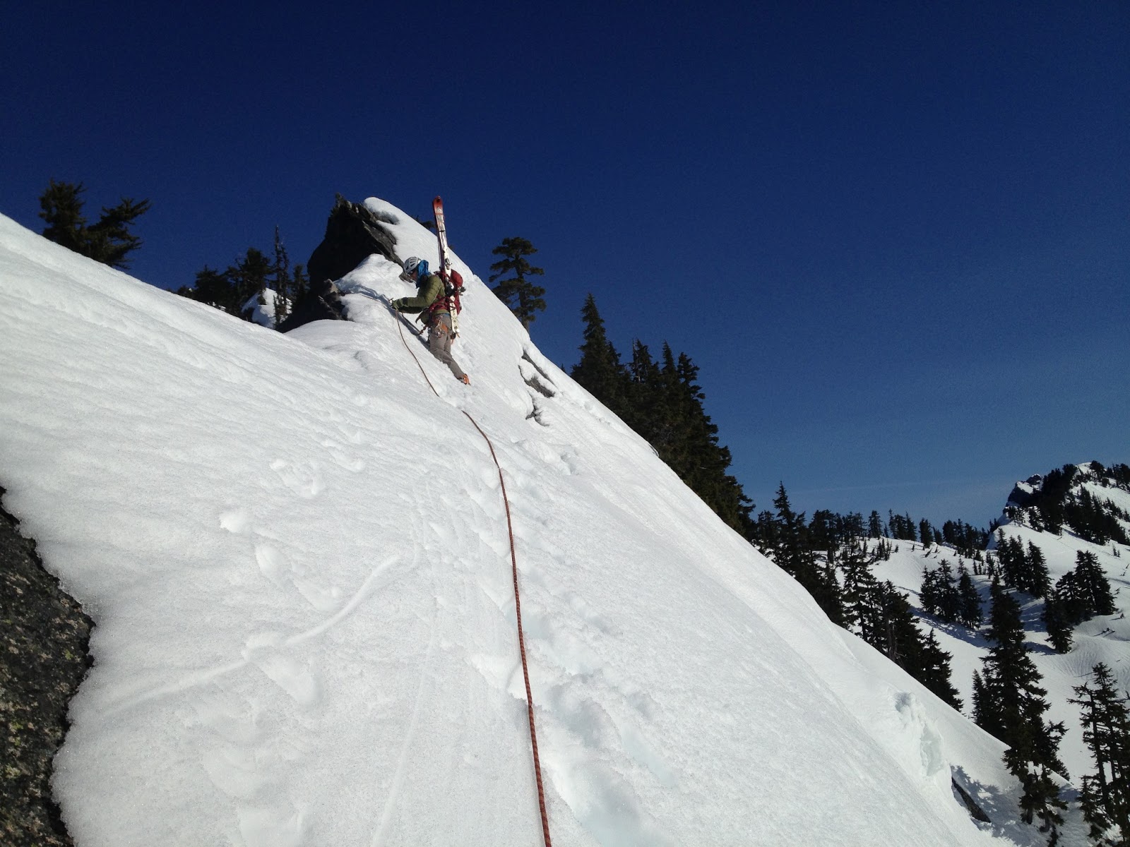
Once we topped out on the col - our timetable began to disintegrate. The next few hundred feet north along the ridge would not be easy going, and would have to be "quickly" pitched out. Drinking in the beautiful scenery as we set up an anchor was consolation for time flying by. I led across the snow traverse which was most sketchy at the beginning where only ~6" of slushy heavy snow clung to the slabs that perched above cliffs.

leading across the Kendall catwalk


One solid cam placement kept me happy, but as I edged away from it and my crampons continuously scraped, I was wanting for some firm foot placements. After setting myself up for a fall long enough to go over the cliffs below, the firm snow finally materialized and I quickly bootpacked it up to a tree to sling and bring Garrett up. Following cautiously, he came up and came past to finish our traverse from the catwalk after an intense effort of ski / tree anchor yoga to get the rope from my left to right side over my pack with skis on it. Those K2 Shuksans are designed to grab ropes, I swear.


Looking past the catwalk at some gnarly terrain
North Cascades or Snoqualmie Pass?


From here on we continued to follow the skintrack that led us quickly down to Ridge Lake. We met up with the guys who had set the skintrack - they had come up the evening before and camped at the col by the catwalk. They too had their sights set on Thomson but after a long slide / fall down the face traversing Alaska, they had retreated to the saddle and were thinking options to get out. Not wanting to bail on the climb before we had suffered further, Garrett and I pushed up the alternate entrance to Bumblebee basin - the col NE of Gravel Lake.

Looking up the face after picking our way back down


There was a good amount of small avalanche debris littering the face - likely from the late afternoon the day prior. As we traversed across and eventually booted up steep sections between small cliffbands, though, stability didn't seem like an issue. The southwest aspect of this face meant it would only really heat up in the late afternoon. At 12:30 once we had reached the top of the ridge we could see down into Bumblebee basin, and a bootpack route to the base of the climb. The hour was too late, however, and we decided to head back.


A tree near Ridge Lake provided much needed shade


backside of Red Mountain with a giant cornice on top
Rainier and some of our route from Kendall catwalk


snow shapes


Neither of us wanted to reverse the catwalk section after it had had more time to slush up and prepare itself for sliding. We had also both heard of horrible exits out Gold creek, but considering we hadn't ever gone up Silver creek before, Gold creek became the only reliable option.

Once again we found a skintrack to take us up out of Ridge Lake - thanks to the folks ahead of us!


Garrett topping out with some great scenery behind

We dropped back down to Ridge lake, cut across the ridge above Alaska Lake and skiied down for a few thousand feet in mellow treed east facing slopes that held decently good snow....bonus! In our excitement upon finding carvable conditions, we skiied a bit too directly down and found our selves in some more committing terrain than we had hoped for. After carefully picking our way through cliffbands and wet slide runouts, we finally crossed Silver creek and came to a stop near Gold Creek.... all we have to do now is follow the creek out, right?

Skiing wasn't bad!

Last turns. Looking up towards Silver creek basin... we continued down and out Gold Creek...


For miles and miles we followed the creek... crossing and recrossing when the conditions appeared better on the opposite side. Comical attempts to "read" the skintrack language of... "did they turn back and go that way" or "did they continue this way?" usually just wasted time. The best option seemed to be follow a track blindly until it turned around on you... then swear and follow it back to the junction and choose again.

...crossing the creek...


Hmmm which way?
...crossing the creek again...

Tree and Silver Peak. I was thankful to start seeing familiar terrain as the sun went down...


We eventually felt the valley starting to widen and cabins began appearing. Night had now mostly fallen as we skiied around a large lake, and then had to traverse right back over to the east side of the valley in order to catch the main road out. Hearing the loud rumble of tractor trailers was never so sweet, as we finally donned approach shoes and walked the road beside the buzzing traffic. We needed to get a further 2 exits down the highway, and that wasn't happening on foot this night. Luckily the WSDOT came through in the clutch and obliged the desperate request for a ride over to Summit West.

Booting time!

Just a stroll along I-90 left

Night photography while walking with a point and shoot.
Thankfully we eventually got a ride from Hyak to West

Many lessons were learned on this trip. Going in or out of Gold Creek will be avoided at all costs. During this time of year with rapidly changing snowpack, it may be unwise to try and day-trip a climb that features a prominent south slope bootpack to access the base. A camp in Bumblebee basin with an alpine start on the rock and an exit early enough to avoid south slope shenanigans seems to be the way to go. Or just waiting for summer.


Sunday, October 28, 2012

October 28, 2012 - Kendall Peak

Our route up from the PCT trailhead at Snoqualmie Pass up to Kendall Peak

The day prior I had headed up to Paradise to ski the October powder up on the Muir snowfield with some friends. Unfortunately the beautiful conditions that we had heard about had deteroriated quickly, and all we found was blowing rain and wet dense heavy snow. A few days later, a quick glance at the Paradise webcam revealed most of the snow was gone - thanks Pineapple Express! Winter will need a reboot, I guess.

The forecast for today was free of rain, thankfully, but the warm front that had moved in thwarted our desires to head up to Baker to explore skiing near Heliotrope. Not wanting a rainfree weekend day to pass uneventfully, we decided to head up to Snoqualmie Pass and hike into and scramble up the North ridge of Kendall Peak, a class 3 scramble. We had been up Commonwealth Basin previously, and Nicole had hiked the catwalk before, but we never scrambled up to the summit. I was also looking forward to scouting out some skiing lines in the area, as I'd heard of some nice couliors in the area.

We drove up through some light rain, but predicably the rain died down as we climbed up to the pass and parked at the PCT trailhead. We were stimyed in finding the climbers trail that heads directly up the Commonwealth basin, despite having using that path in the winter several times. We opted for the longer and more gradual PCT climb, with hopes of taking the climbers trail out to see where it ends and to cut off a few miles.

The hike up went fairly quickly, though I think it was longer than the 5 miles that was written up in Smoot's guide. We found the junction that we would try to take on the way back to follow the climber's trail more directly back to the cars and continued heading up until we arrived at the flat clearing below the large broad W facing bowl on Kendall's south ridge. The PCT winds its way far to the south and traverses back above some cliffs to gain the ridge above the bowl. The direct way up following the creek, however, was much shorter, so it must be quicker, right!? Somehow I was able to convince Nicole to try it. We could see about where the PCT cut across the high bowl, and it was gradual up to that point, but after tiptoeing across our fourth snow covered log with blind footsteps falling off the side of the log Nicole pulled the plug and we both made our way back to the trail and wound our way up to the ridgeline in just a few minutes.
Shoulder season scene
We took a break and had lunch at a convenient spot with views out towards Snoqualmie, Red, Lundin and the approach up towards Kendall itself. Already about 5 miles in, and unsure if we'd be able to cash in on the promise of a shorter deproach via the climber's trail, Nicole decided to head down. Assured that she was fine heading down the trail, I continued up to try and tag the peak and race down to the car. I followed the trail as it wound directly below the summit. I saw some folks just starting up nearby where the summer trail ought to be. There was about 4-6" of snow by this point, just enough to hide the rocks underneath, but not enough to properly kick steps. Shoulder season! I decided to continue on, hoping the North ridge would be in good condition, and looking foward to the class 3 moves along it. I was glad there would be footsteps down the South face, though, as I planned to take that down.

As I gained the notch N of the summit, it became apparent that there was more snow on the ridge than I had bargained for. There was plenty of rock exposed to scramble up, but in many places only one or two variations of snow free scrambling would be available, forcing you into harder rock moves than would be necessary in the dry summer. I walked around the east side and gained the ridge and climbed up for about 10 minutes before deciding this class 3 scramble wasn't in the stars for me today. I didn't much feel like climbing class 4 rock with the possibility that the only way forward or backward afterward would be class 4 downclimbing.

Back at the notch I took the trail 300' back downhill and decided to try and climb up a couloir that gained the ridge beyond the small bump I didn't want to climb. It was a scree field underneath, but the depression had accumulated more snow than the surrounding area, and snow steps were just barely possible. I climbed right up the gut where the snow was deepest and got within about 20' of the top before it started to get spicy again. The snow got shallower and the scree underneath transitioned abruptly to slab. (Curious sidenote - I wonder if this transition is important for avy danger here - the slab is right at the start zone, but we don't OFTEN get terminal slides in mid-winter, right??). 


scene of the hidden snow slab climbing
I was forced to brush off enough snow to get foot holds on the slab and after a few teasnious moves, I was able to get good handholds on the ridge crest itself and I pulled myself up. The view was not enticing. The ridge went up and down along similar terrain that I was on until the summit, still perhaps a quarter mile distant. I didn't have time to slowly work my way over along the ridge... had to descend! The initial downclimb on the slab was spicy, but once back in the gulley proper, somewhat positive plunge stepping deposited me back on the PCT.

I continued back on the trail until I saw the footsteps heading up following the summer trail. Not wanting to give up on the summit altogether, I decided to give it a go. A few minutes up I met the gentleman coming down who had put in the steps. He made it to the top, so I figured it was good to go - a quick thanks and he and his Australian shepard jetted down the trail looking to catch up to his wife. I followed the steps up (always follow the bootprints, dogs sometimes climb themselves into dead ends!!) and soon the summit was within reach. 

the last bit of ridge walking to the summit

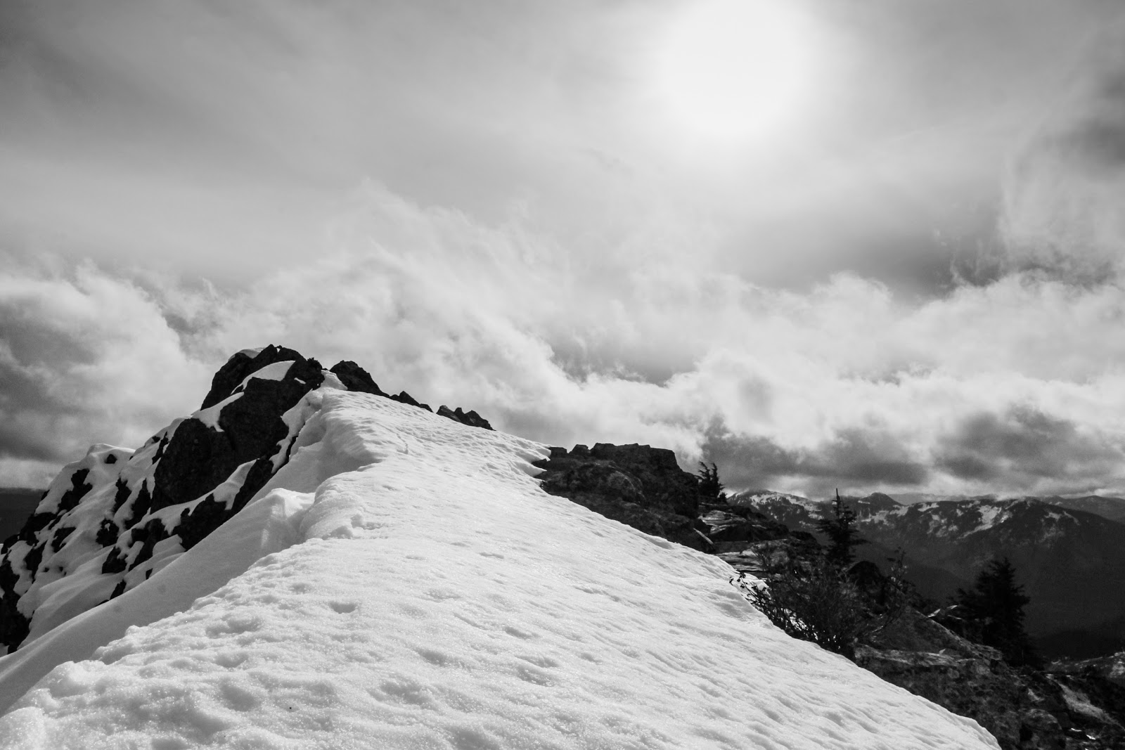
I topped out a bit early and had to traverse the ridgeline for a few hundred feet, but it was not nearly as bad as further below on the N. ridge. I took a bunch of pictures of all the nearby peaks in their new snow cover (probably all gone now a few weeks later) and then headed down.
Red mountain, obviously.
Thomson! High on the list. Route looks snowfree here! Should have daytripped it

Sunny view from the summit
Once on the trail I stashed my camera, buttoned down the pack and ran most of the way back to the junction with the climber's trail. The PCT was perfect for this - a gradual downhill made for an easy quick jog. I took the cilmbers trail down, and took a quick left off it, hoping to get down to the creek and eventually find the log crossing we've used in the winter. I'd have to cross the creek at least once to get in the middle, however, before taking that log crossing out near the end of the trail. The trail petered out at some point and I ended up having to schwack a ways downstream before eventually crossing and finding a good path on the North side of the southern most creek (it's a maze in there). I'm sure this path connected somehow with the turnoff from the PCT further upvalley from where I schwacked. Following the trail downstream, the log crossing soon revealed itself, and I knew I was home free. Another mile or so of steeper downhill and I was back - a beautiful day in the mountains for late October!

Monday, June 25, 2012

June 25, 2012 - Silver Peak

Plans shifted back and forth on a bid to ski Silver. The season for easy access and good skiing is short on Silver - it's an easy approach (can't get easier) once the road is open to Windy Pass, but the snow melts out and reveals base ripping rocks only a few weeks after the road is open. With sketchy weather our plans kept changing. We finally opted for a Tuesday night bivy ahead of a Wednesday - Thursday weather window.... not sure how that made sense, but it seemed to.

I raced home early from work, grabbed the ride and picked up Zahlen and Pat in downtown, where we commenced the crux of the trip: navigating downtown Seattle traffic at rush hour. We managed to sit around on Western for a number of light cycles before bailing to Alaska, which despite the construction provided easy access to SoDo, burritos, Beacon Hill and Skye. The car being full, we headed up to the pass, and made our way to the end of the road.

Views improved as we climbed, with breaking clouds providing some good views, and a hope for perhaps a bit of a sunset to watch from the ridge.

Snoqualmie Pass clouds
 The clouds decided to gather strongly at the summit instead of breaking, however, and as we climbed, visibility dropped and, despite the wager of burrito bites, Rainier was not visible from the ridge.


Pat and old tracks
We skinned up to the ridge via some soft snow and dropped packs. Skye and I dropped over to the SW side of the ridge to scramble up to the summit while the rest lapped up the slope below camp. The rocky trail and scramble proved difficult, because we actually didn't drop packs... for some reason... perhaps hoping for a camp spot big enough for 4.... we got to the top, enjoyed some "views" had a quick snack and headed down. The downhill we stayed on the trail proper, which made the traveling much better in the AT boots.


Skye on summit
We then got one lap under out belts before setting up camp to a light pattering of rain. During the night I kept checking for stars, and thankful each time that they weren't out there to pull me out of the bivy to take pictures. The sun rose early revealing beautiful light on Rainier. The morning dew was still strongly adhered to my front element, however, and all shots of Rainier came out just like I felt that morning... a little wet. The sun finally hit our slopes, however, warming and drying quickly, and softening up the snow slowly.

sunrise, hours after daybreak

Filtered light and remnants of moisture on my lens causing some "rainbows"

With thoughts of getting to work not THAT late, we finally pushed off to ski down, before the skiing was all that great. Upper slopes were nice, but in the shade lower down it quickly got icy. The top few turns were well worth it, however, and the rest of the day at the office went by easily with the satisfaction of morning of skiing.

Pat hucking the ridge

Saturday, March 24, 2012

March 24, 2012 - Mt Catherine

After some monumental snow accumulations through March, Nicole and I along with friends Dave and Kristen set out to go ski some of the newly fallen powder. Thoughts of Paradise were scrapped after high elevation south facing terrain was deemed too likely to load up under the sun. We set our sights on Silver Peak's North facing bowls. While climbing past Mt Catherine, however, we decided to just hit that up instead, why ski past good looking slopes of powder??

Our ascent up Hyak face; down into Hidden Valley nordic trails; up an established skin track to Mt. Catherine summit
This happened to be the second time recently that I've looked to repeat a ski summit from last year with different friends. Previously this year I had set out for Jove Peak and was turned back just shy of the summit by an active, but shallow, surface layer. Summit or not, I've found the return trip to be much more navigationally friendly. All the planning on Google Earth doesn't equate to having been somewhere looking at the terrain, especially in the winter! This time we avoided any stream crossings which made the last Mt Catherine trip so much fun:


Skye attempting the crux stream crossing during last year's ascent

Nordic trails guided us easily over Mill Creek and we set off towards Windy Pass. The skin track and our powder desires brought us higher up Mt. Catherine than needed for a Silver ascent and instead of fighting it, we flowed uphill, not wanting to see perfectly good powder get all wet and heavy before getting some turns on it. High whispy clouds kept the sun's strength at a minimum for much of the morning, preserving the snow for our afternoon descent. As we gained the summit the sun began to win the battle with the clouds and especially out to the East blue skies were in order.


Mt Catherine views: Southwest (L) to Northwest (R)
The turns off the summit were supreme - light fluffy powder. Whooping and hollering we made our way down and enjoyed a nice lunch under the trees... until they started sending bombs our way.

tuns off the summit

Dave ripping it up just below the summit
We basically followed our skin track out and glided back down to the nordic track for a quick climb up the backside of Hyak. I found my recently unwaxed skis perfectly fine without skins and motored up. Should probably wax those before skiing any concrete this spring / summer....

Final look back towards Windy Pass (center right) and Mt. Catherine (left)
 The last run of the day out the frontside of Hyak was amazing groomed courdury. Just ripping! Perfect timing... powder when it was light, and some grommers on the way out when it was getting heavy.