Showing posts with label snow. Show all posts

Sunday, October 28, 2012

October 28, 2012 - Kendall Peak

Our route up from the PCT trailhead at Snoqualmie Pass up to Kendall Peak

The day prior I had headed up to Paradise to ski the October powder up on the Muir snowfield with some friends. Unfortunately the beautiful conditions that we had heard about had deteroriated quickly, and all we found was blowing rain and wet dense heavy snow. A few days later, a quick glance at the Paradise webcam revealed most of the snow was gone - thanks Pineapple Express! Winter will need a reboot, I guess.

The forecast for today was free of rain, thankfully, but the warm front that had moved in thwarted our desires to head up to Baker to explore skiing near Heliotrope. Not wanting a rainfree weekend day to pass uneventfully, we decided to head up to Snoqualmie Pass and hike into and scramble up the North ridge of Kendall Peak, a class 3 scramble. We had been up Commonwealth Basin previously, and Nicole had hiked the catwalk before, but we never scrambled up to the summit. I was also looking forward to scouting out some skiing lines in the area, as I'd heard of some nice couliors in the area.

We drove up through some light rain, but predicably the rain died down as we climbed up to the pass and parked at the PCT trailhead. We were stimyed in finding the climbers trail that heads directly up the Commonwealth basin, despite having using that path in the winter several times. We opted for the longer and more gradual PCT climb, with hopes of taking the climbers trail out to see where it ends and to cut off a few miles.

The hike up went fairly quickly, though I think it was longer than the 5 miles that was written up in Smoot's guide. We found the junction that we would try to take on the way back to follow the climber's trail more directly back to the cars and continued heading up until we arrived at the flat clearing below the large broad W facing bowl on Kendall's south ridge. The PCT winds its way far to the south and traverses back above some cliffs to gain the ridge above the bowl. The direct way up following the creek, however, was much shorter, so it must be quicker, right!? Somehow I was able to convince Nicole to try it. We could see about where the PCT cut across the high bowl, and it was gradual up to that point, but after tiptoeing across our fourth snow covered log with blind footsteps falling off the side of the log Nicole pulled the plug and we both made our way back to the trail and wound our way up to the ridgeline in just a few minutes.
Shoulder season scene
We took a break and had lunch at a convenient spot with views out towards Snoqualmie, Red, Lundin and the approach up towards Kendall itself. Already about 5 miles in, and unsure if we'd be able to cash in on the promise of a shorter deproach via the climber's trail, Nicole decided to head down. Assured that she was fine heading down the trail, I continued up to try and tag the peak and race down to the car. I followed the trail as it wound directly below the summit. I saw some folks just starting up nearby where the summer trail ought to be. There was about 4-6" of snow by this point, just enough to hide the rocks underneath, but not enough to properly kick steps. Shoulder season! I decided to continue on, hoping the North ridge would be in good condition, and looking foward to the class 3 moves along it. I was glad there would be footsteps down the South face, though, as I planned to take that down.

As I gained the notch N of the summit, it became apparent that there was more snow on the ridge than I had bargained for. There was plenty of rock exposed to scramble up, but in many places only one or two variations of snow free scrambling would be available, forcing you into harder rock moves than would be necessary in the dry summer. I walked around the east side and gained the ridge and climbed up for about 10 minutes before deciding this class 3 scramble wasn't in the stars for me today. I didn't much feel like climbing class 4 rock with the possibility that the only way forward or backward afterward would be class 4 downclimbing.

Back at the notch I took the trail 300' back downhill and decided to try and climb up a couloir that gained the ridge beyond the small bump I didn't want to climb. It was a scree field underneath, but the depression had accumulated more snow than the surrounding area, and snow steps were just barely possible. I climbed right up the gut where the snow was deepest and got within about 20' of the top before it started to get spicy again. The snow got shallower and the scree underneath transitioned abruptly to slab. (Curious sidenote - I wonder if this transition is important for avy danger here - the slab is right at the start zone, but we don't OFTEN get terminal slides in mid-winter, right??). 


scene of the hidden snow slab climbing
I was forced to brush off enough snow to get foot holds on the slab and after a few teasnious moves, I was able to get good handholds on the ridge crest itself and I pulled myself up. The view was not enticing. The ridge went up and down along similar terrain that I was on until the summit, still perhaps a quarter mile distant. I didn't have time to slowly work my way over along the ridge... had to descend! The initial downclimb on the slab was spicy, but once back in the gulley proper, somewhat positive plunge stepping deposited me back on the PCT.

I continued back on the trail until I saw the footsteps heading up following the summer trail. Not wanting to give up on the summit altogether, I decided to give it a go. A few minutes up I met the gentleman coming down who had put in the steps. He made it to the top, so I figured it was good to go - a quick thanks and he and his Australian shepard jetted down the trail looking to catch up to his wife. I followed the steps up (always follow the bootprints, dogs sometimes climb themselves into dead ends!!) and soon the summit was within reach. 

the last bit of ridge walking to the summit

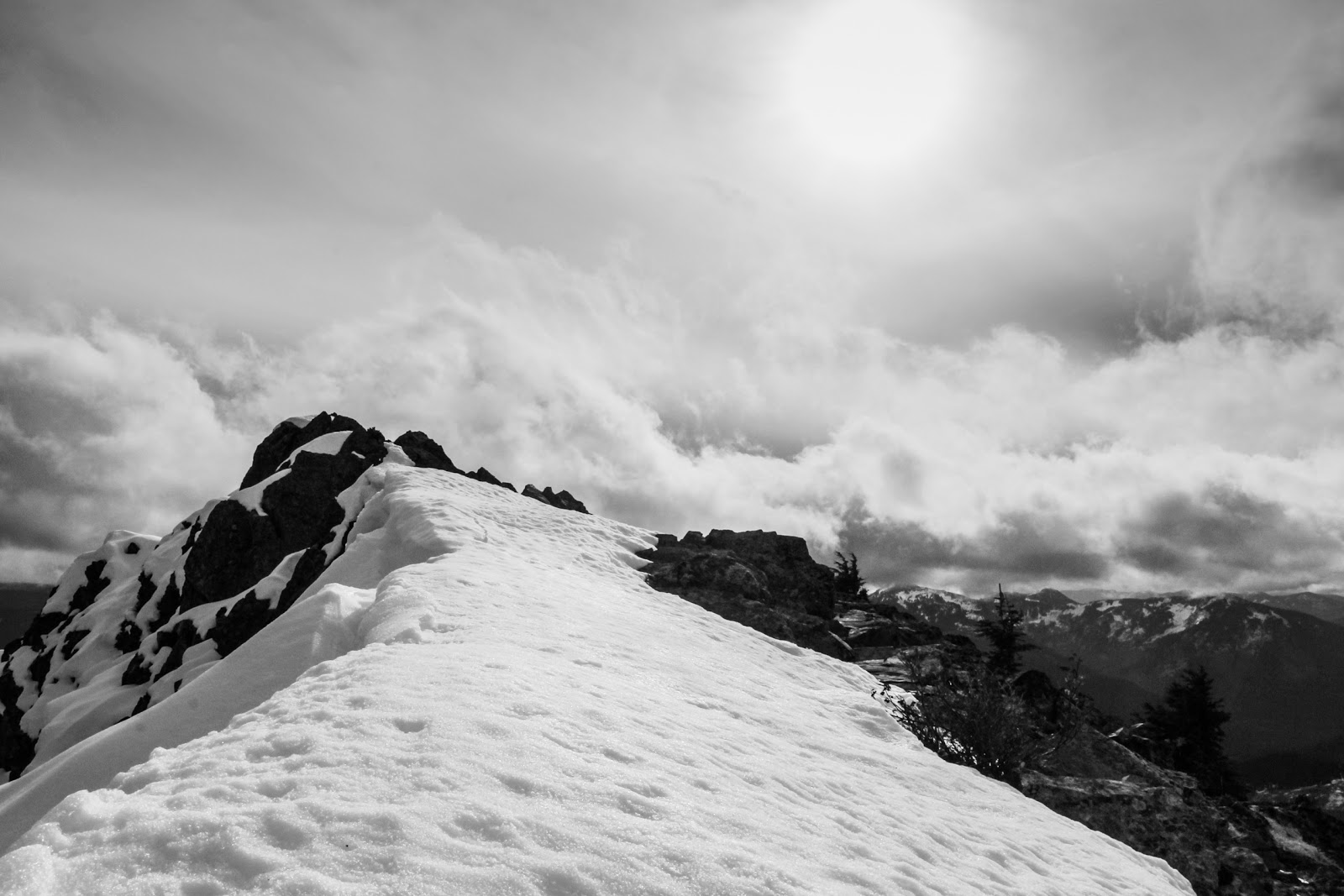
I topped out a bit early and had to traverse the ridgeline for a few hundred feet, but it was not nearly as bad as further below on the N. ridge. I took a bunch of pictures of all the nearby peaks in their new snow cover (probably all gone now a few weeks later) and then headed down.
Red mountain, obviously.
Thomson! High on the list. Route looks snowfree here! Should have daytripped it

Sunny view from the summit
Once on the trail I stashed my camera, buttoned down the pack and ran most of the way back to the junction with the climber's trail. The PCT was perfect for this - a gradual downhill made for an easy quick jog. I took the cilmbers trail down, and took a quick left off it, hoping to get down to the creek and eventually find the log crossing we've used in the winter. I'd have to cross the creek at least once to get in the middle, however, before taking that log crossing out near the end of the trail. The trail petered out at some point and I ended up having to schwack a ways downstream before eventually crossing and finding a good path on the North side of the southern most creek (it's a maze in there). I'm sure this path connected somehow with the turnoff from the PCT further upvalley from where I schwacked. Following the trail downstream, the log crossing soon revealed itself, and I knew I was home free. Another mile or so of steeper downhill and I was back - a beautiful day in the mountains for late October!

Saturday, September 1, 2012

September 1st, 2012 - La Sage - Cabane de Moiry

Day 6 on the Haute Route. Despite the titles, we were actually in Les Hauderes the past night, and needed to walk up to La Sage before we could start the hike of the day. 

Our route up from Les Hauderes up to col du Tsate, down to the base of Glacier de Moiry and up to the cabane

This would be one of the longer days including the most climbing, so we were looking for a way to skip out on the walk to La Sage. The bus didn't leave until around 9AM, and we wanted to get an earlier start than that, so after breakfast we tried our luck waving a car down. As we walked up the road, a few cars passed until finally one pulled over, right where the path was about to cut up and away from the road. As we got into the car we could see a party of 3 hiking up the trail above us - we'd get a jump on them, we though!

Nicole starting the walk up to La Sage that would end.... in a car :)


We zipped up to La Sage in the back of a Honda full of hay. Though we couldn't communicate very well, the woman was obviously a bit worried we'd find her car too dirty - obviously she hadn't gotten a wiff of us yet!

She let us out near the town center, and we consulted the guidebook for directions out of the town onto the track. We vaguely matched up the description of the town with what we saw, and decided that we must be going the right way. A single yellow sign that directed us towards a village further uphill seemed to indicate that we were on the right path. As we climbed, the way got less and less clear, paths diverged and shrank, and we soon found ourselves at the edge of some steep fields with small game trails going up into the woods. Didn't feel right... we saw a road a few hundred feet below us, so we decided we ought to get to the road and get reoriented. Cutting through farmers fields and people's backyards, we finally got down to the road, and we ran into the group of three we had seen from below while snagging our ride up the road. It was a group of three from Israel, and we teamed up with them for most of the climb up to the col. They were walking out from the ACTUAL town center, which we hadn't been to, so with our bearings now recalibrated, we headed out uphill.

As we wound our way higher, we passed a number of ski lifts and small cabins for rent. One even had some smoke out the stack as the occupants were warming up on the brisk morning.

Cabin and dents de veisivi behind

After two days of rain and snow, the grand views were spectacular

We passed a few small villages high up on the hillside, and eventually came to a junction where the trail meant to bring us straight up a loose gully directly up to the col. We opted to take the road cut up and around instead, especially since we had seen some hikers about an hour ahead of us navigate that way rather easily.

Nicole making her way up along the road cut
As we neared the Remonte du Tsate, we saw a large long building and heard the bells and noise of cattle inside. They surely heard us coming as well, and probably figured they were about to be fed, but alas we didn't offer up any powerbars. They were a noisy lot, though!


Cows below col du Tsate from Erik Turner on Vimeo.

Now we turned directly uphill and could see the col, or at least a notch we thought could be the col. Up to this point we were able to walk on wet trail and road, but had avoided the snow. Now we were following steps in the snow, which at its deepest only got to about ankle height. We began up and only a few minutes above the cattle came to a beautiful lake with a great view. It reminded us of the enchantment basin in the eastern cascades.

Beautiful lake and views of snowy peaks
As we climbed, the views off to our right got bigger and better. Glaciers and more distant peaks came into view. The skies stayed a dark blue with only innocent puffy white clouds there to provide context to the peaks thrusting up into the sky.

snowy peaks and glaciers
The last bit of scrambling up to the col was made fun by the inches of snow laid on top of the slick rocks. With careful balance and the aid of previous footsteps we scampered up to the col and met quite a scene. A group from Seattle was having lunch, so we chatted with them, naturally, but we were also witness to some fit looking guys running up to the pass with large packs on, which they quickly produced parachutes from. Paragliders! We learned there was a paragliding race on over the last few days - the racers were tasked with trying to visit as many huts as possible in 4 days. They had been cooped up for the last two due to bad weather, so they were out in full force on this bluebird day to chase down some points. We watched different paragliders for the rest of the day as they found thermals, rose up hundreds of feet, and proceeded to fly up and over cols above us.... it was intense!

We also broke for lunch at the col, enjoying the warm sunshine, amazing views and nutella. Anxious to move onward, we didn't stay long as we sought to finally catch a glimpse of the cabane and the nearby glacier. As we descended form the col we saw impossible switchbacks carved into the rock face on the other side of the valley.... that couldn't be the way up to the cabane... right?

Well we learned that the short climb at the end of the day up to the cabane would be a bit more than we bargained for! We needed to descend all the way to the terminal lake up the moraines on the other side and then up steep switchbacks to the cabane. Probably should have studied the map a bit closer, but we had plenty of time, so we took off down the rest of the descent.

Nicole after descending from the col du Tsate with the icefall coming into view behind

Terminal lake and Moiry icefall
From the terminal lake we climbed up through cattle fields into increasingly rocky terrain. One particular bull obviously liked standing on the trail directly above a bridge over a small creek. There was a well worn trail that went down from the bridge, skipped over the creek on a few rocks, and then back up the trail beyond where this bull was standing... suggesting that many folks had avoided skirting too close to this bull before! We followed the trail and gave him some space.

Nicole climbing higher up towards the cabane
The snow that we had left on the col du Tsate came back, and soon we were walking up through upwards of 6" of snow. There had been enough traffic up and down, however, that the trail was fairly evident, and our feet could stay dry. Hiking up to the cabane is a popular day trip, as there is a road up to the terminal lake.


clinging onto spring

racing paragliders
We trudged up the road through the cattle fields and eventually were on the switchbacks that we had spied from across the valley. We tried to keep count... seeking to hit the magical number of 16, which we had counted from the col. After about 17 or 18, we were looking forward to seeing the cabane, which was doing a very good job of hiding around the top of the slope above us. Finally I shouted down that there was a flag! And the flag was in a courtyard... next to the cabane! It had been a fairly long day on the trail, and we were happy to throw our packs down and relax in the most beautiful dining area ever created by man:

best dining room ever.
Unfortunately my knee had taken quite a beating on this day. The climbing hadn't bothered it while we were moving, but I could feel it tightening up rapidly. Plenty of advil and a few beers helped to relieve or ignore the pain, but I could tell the hiking wouldn't quite be the same for the rest of the trip. I stretched as much as I could and hoped for the best. Meanwhile, we enjoyed the views out the windows, settled into our room and charged up the camera batteries thanks to the extra adaptors our Seattle friends had brought.

Dinner was a carrot and beet heavy salad, lasagna and some sort of sherbet for dessert. The food was decent, but we mostly enjoyed chatting with the Seattle crew and continuously gawking out the windows at the icefall.


cloud formations above the glacier moiry

clouds lit up a bit at sunset

A very short window of colorful light at sunset
I continued to pump advil through the night, and we knocked off pretty early, having fairly tired legs. This was one of the best days of the hike, however, as we really felt like we were hiking away from civilization for much of it. The cabane was not overshadowed by ski lifts, we weren't looking down over a village - we were perched below a remote glacial icefall.

Thursday, August 30, 2012

August 30, 2012 Haute Route: Prafleuri - Arolla


Day 4 of our Haute Route. Probably day 6 or 7 by the guidebook.

Route up and over col de Roux, descent down to Lac de Dix, climb up to Col de Riedmatten, and final descent to Arolla.
Having arrived through a wet and soggy day yesterday, we were excited to find dry clothes downstairs and the prospect of walking in good weather. We found dry clothes downstairs (sortof) and it wasn't currently precipitating when we woke up, so we were all pretty excited. Choking down breakfast, we kept our eyes on the clouds, which had deposited about an inch of snow overnight, but were at the moment looking fairly innocent.

Cabane Prafleuri as we climbed up in the morning

Some of the groups traveling together split up today, as some folks made their way directly over towards the damn at the outlet of the lake and took the bus around instead of hiking the passes in snowy conditions. Due to that, everyone regrouped a bit and we teamed up with Melanie and Sven - friends we had met at Mont Fort. Stepping outside, everyone stopped and put on another layer... it was chilly! Even though we were walking uphill for the first 30 minutes, I kept the warm layers on and enjoyed the steady climb up the col de Roux. For the first and only time in the trip we beat the in-form Uli Steck time they use on the signposts. We had a celebratory high five at the top, enjoyed a little bit of a view towards Lac des Dix, and started our speedy descent down to the lake, hopeful that the ibex that often graze on the slopes would show themselves.

View of Lac de dix from col de Roux. Our path followed the near shoreline of the lake


And the ibex certainly showed themselves! A whole herd of them appeared on our left and a bit downhill from us. Perhaps 30-40 of them. Having only my 17-50 lens, they were a bit too far away for decent photos, however as we descended further a number of them were closer to the trail and I was able to frame some of them against the mountainous background. Sven kept a lookout for other likely close by ibex, and together we stalked them seeking the elusive good view that did not encourage a charge in return. They actually didn't even seem to notice us, and continued grazing lazily.

A heavy crop of an ibex image.
We continued to head down from the col into generally cloudy conditions, with views peaking out every once in a while. Rocky ridges would reveal themselves for a moment before being swallowed back up into the foggy clouds that kept descending down from the glaciated terrain on our right.

Trail and views high above Lac de Dix

The mountains at the inlet of the lake reveal themselves, momentarily.
As we descending lower down to the lake the snow began to pick up. It was never a winter storm with blowing winds, but the snow was dropping steadily enough for us to think hard about whether we wanted to climb up and over a col later that afternoon. A long easy stroll along the lake was pleasant enough, but we were all hoping the conditions once we got off this large trail (basically a road) would prove good enough to allow us to continue.


Snow from Erik Turner on Vimeo.


Snow began accumulating as we walked along the lake.
After climbing a short ways up from the lake and seeing the snow cover on the rocks, Melanie decided she ought to flip it around and get back to the bus at the head of the dam. Our plan was to try climbing the passes, but we could always bail to the cabane nearby (Cabane de dix) but Melanie had friends waiting in Arolla, and the sure way to get there was the bus on the other side of the lake. Sven, Nicole and I pushed on, with Sven usually taking off and blazing trail and waiting up for us every once in a while. We saw him a little ways ahead, past the junction that lead up to the col de Ridmatten. Confused... we waited a few minutes and watched as he led a fairly big group across the non technical glacier crossing over towards the cabane. Figuring he just wanted a hot beverage, we pushed on up the col. Found out later he was actually a bit turned around and accidentally went there and had the spend the night!

We began our climb up the col, thankfully following footsteps for the whole way. For much of the ascent the footsteps seemed able to follow a somewhat level trail that wound its way around the boulders and up towards the col. 

Erik climbing up the col de Ridmatten

Eventually at the very top we could see the chains that marked the final scramble, but the first set of chains was difficult to get to due to some ice on the rocks in front of us. We climbed directly up for a few sketchy moves and grabbed the second set of chains, and from there on climbed up to the col quickly and easily.... phew! We had learned earlier that the other side of the col was an easy grassy trail - not the rocky mess that we had just climbed, so we figured all technical difficulties for the day were now behind us.


Looking down at the col de Ridmatten - the chains were nice to have at the top!
Indeed we did descend on a great trail, wandering down through the clouds and light breeze. Now on the downhill we caught more of a chill, and took a break behind some rocks to throw down some food and layer up. We kept dropping through the snow and clouds, eventually coming to roads, ski lifts and the edges of farmland.

Nicole descending into the fog

Breaking out under the clouds!
Eventually we found ourselves on a nature walk for some hotel on the outskirts of Arolla. After looking at the map, we realized the hotel was the Kraushaus - the place we had heard about and were aiming for anyway! We followed the numbered markers along and in no time were dropping off our stuff in our room and warming up by the blazing fire.


Nicole spreading out our gear in the room to dry

Saturday, May 26, 2012

May 26 2012 - Mt Shuksan

Nicole and I along with a number of friends have been gearing up for lots of climbing this spring and summer. Plans for Hood and Shasta were hatched after we had Mt St Helens in our legs. I can't complain too much about this spring, it has been much more predictable than last year, but storms still managed to get the better of our Hood and Shasta plans. For several weeks we did what most climbers do in fickle weather- fled to Leavenworth, basked in the eastside sun and gorgeous weather and got on some granite. Those trips were great, but it left me wanting to make turns in creamy corn snow...


Approach to Pearly Gates
A long drive down to Shasta and a repeat of last year's Memorial Day climb were on tap, but the 50+mph wind predicted convinced us to look elsewhere. The weather looked much better in the North Cascades, and Shuksan quickly popped into my mind as an easy glacier climb to do in order to dial in our system for the year. Emails were sent, plans were hatched and before I knew it we were at the trailhead heading up towards the snow. We had managed to drive all the way to within about a half mile of the trailhead, so the approach was rather straightforward. We followed the tracks of a climbing ranger on skis and a NOLS group and separate guided group both on foot. About a mile up the trail we hit continuous snow and switched over to snowshoes and skis. A bit of slog along the trail and a climb to gain Shannon Ridge yielded amazing views of Koma Kulshan.

Nicole topping out on Shannon Ridge

The last few slopes of the day were softening up quickly and wet slides flanked the shallow gullies along the sides of the broad ridge we climbed. Careful but straightforward route finding yielded safe passage to the first notch were we happily dropped packs and began to throw tents down. After some crevasse rescue practice and dinner and we lounged on our snow couch and enjoyed the beautiful evening light.

Sun slipping down past Artist Point

Koma Kulshan, stars and a bright moon over camp
Stars and cornices above camp
Morning light burns off the fog... but not all of it...
We woke in the morning to foggy conditions as visibility faded in and out towards the Pickets and ominously Kulshan stayed fully cloaked in clouds just off to our west. We geared up and made our way up to the glacier and began to navigate by following the few footsteps that we could see in front of us.
Visibility on the Sulphide
After some discussion and slowly picking our way higher we finally broke out of the clouds into gorgeous views of the nearby high peaks.
Sunshine!
Visibility went in and out a few times, but soon blue skies dominated, and not too long after a clear shot of the summit pyramid came into view. It didn't look far... but, it was.
Summit pyramid finally in view... a few hours up the glacier
tracks


The race against the already warm and saturated snow and sun was on, and we were already well behind. Arriving near the summit pyramid it was already about noon, and we had about 6 miles and 6000' to travel before arriving back at the car. We made the decision to traverse over towards the Nooksak Ridge and enjoy some views before flipping it around and heading downhill. The gulley looked fat and I had entertained ideas of skiing from the summit, but I knew that in the heavy snow it wouldn't have been that great. We descended quickly on the upper slopes, and the intrepid climbers on foot then struggled a bit on the flat slog portion of the glacier before finally glissading a few good slopes down towards camp. 

Climbers descending the Sulpide glacier

We got out to the car in plenty of time to drive out in daylight. A perfect end to the trip was a stop for mexican grub in Burlington. Next up... Koma Kulshan (yes... "Baker").

A bit of recap, and my first take at video here:

Mt Shuksan from Erik Turner on Vimeo.