|
| Our route up from the PCT trailhead at Snoqualmie Pass up to Kendall Peak |
The day prior I had headed up to Paradise to ski the October powder up on the Muir snowfield with some friends. Unfortunately the beautiful conditions that we had heard about had deteroriated quickly, and all we found was blowing rain and wet dense heavy snow. A few days later, a quick glance at the Paradise webcam revealed most of the snow was gone - thanks Pineapple Express! Winter will need a reboot, I guess.
The forecast for today was free of rain, thankfully, but the warm front that had moved in thwarted our desires to head up to Baker to explore skiing near Heliotrope. Not wanting a rainfree weekend day to pass uneventfully, we decided to head up to Snoqualmie Pass and hike into and scramble up the North ridge of Kendall Peak, a class 3 scramble. We had been up Commonwealth Basin previously, and Nicole had hiked the catwalk before, but we never scrambled up to the summit. I was also looking forward to scouting out some skiing lines in the area, as I'd heard of some nice couliors in the area.
We drove up through some light rain, but predicably the rain died down as we climbed up to the pass and parked at the PCT trailhead. We were stimyed in finding the climbers trail that heads directly up the Commonwealth basin, despite having using that path in the winter several times. We opted for the longer and more gradual PCT climb, with hopes of taking the climbers trail out to see where it ends and to cut off a few miles.
The hike up went fairly quickly, though I think it was longer than the 5 miles that was written up in Smoot's guide. We found the junction that we would try to take on the way back to follow the climber's trail more directly back to the cars and continued heading up until we arrived at the flat clearing below the large broad W facing bowl on Kendall's south ridge. The PCT winds its way far to the south and traverses back above some cliffs to gain the ridge above the bowl. The direct way up following the creek, however, was much shorter, so it must be quicker, right!? Somehow I was able to convince Nicole to try it. We could see about where the PCT cut across the high bowl, and it was gradual up to that point, but after tiptoeing across our fourth snow covered log with blind footsteps falling off the side of the log Nicole pulled the plug and we both made our way back to the trail and wound our way up to the ridgeline in just a few minutes.
 |
| Shoulder season scene |
As I gained the notch N of the summit, it became apparent that there was more snow on the ridge than I had bargained for. There was plenty of rock exposed to scramble up, but in many places only one or two variations of snow free scrambling would be available, forcing you into harder rock moves than would be necessary in the dry summer. I walked around the east side and gained the ridge and climbed up for about 10 minutes before deciding this class 3 scramble wasn't in the stars for me today. I didn't much feel like climbing class 4 rock with the possibility that the only way forward or backward afterward would be class 4 downclimbing.
Back at the notch I took the trail 300' back downhill and decided to try and climb up a couloir that gained the ridge beyond the small bump I didn't want to climb. It was a scree field underneath, but the depression had accumulated more snow than the surrounding area, and snow steps were just barely possible. I climbed right up the gut where the snow was deepest and got within about 20' of the top before it started to get spicy again. The snow got shallower and the scree underneath transitioned abruptly to slab. (Curious sidenote - I wonder if this transition is important for avy danger here - the slab is right at the start zone, but we don't OFTEN get terminal slides in mid-winter, right??).
 |
| scene of the hidden snow slab climbing |
I was forced to brush off enough snow to get foot holds on the slab and after a few teasnious moves, I was able to get good handholds on the ridge crest itself and I pulled myself up. The view was not enticing. The ridge went up and down along similar terrain that I was on until the summit, still perhaps a quarter mile distant. I didn't have time to slowly work my way over along the ridge... had to descend! The initial downclimb on the slab was spicy, but once back in the gulley proper, somewhat positive plunge stepping deposited me back on the PCT.
I continued back on the trail until I saw the footsteps heading up following the summer trail. Not wanting to give up on the summit altogether, I decided to give it a go. A few minutes up I met the gentleman coming down who had put in the steps. He made it to the top, so I figured it was good to go - a quick thanks and he and his Australian shepard jetted down the trail looking to catch up to his wife. I followed the steps up (always follow the bootprints, dogs sometimes climb themselves into dead ends!!) and soon the summit was within reach.
I continued back on the trail until I saw the footsteps heading up following the summer trail. Not wanting to give up on the summit altogether, I decided to give it a go. A few minutes up I met the gentleman coming down who had put in the steps. He made it to the top, so I figured it was good to go - a quick thanks and he and his Australian shepard jetted down the trail looking to catch up to his wife. I followed the steps up (always follow the bootprints, dogs sometimes climb themselves into dead ends!!) and soon the summit was within reach.
 |
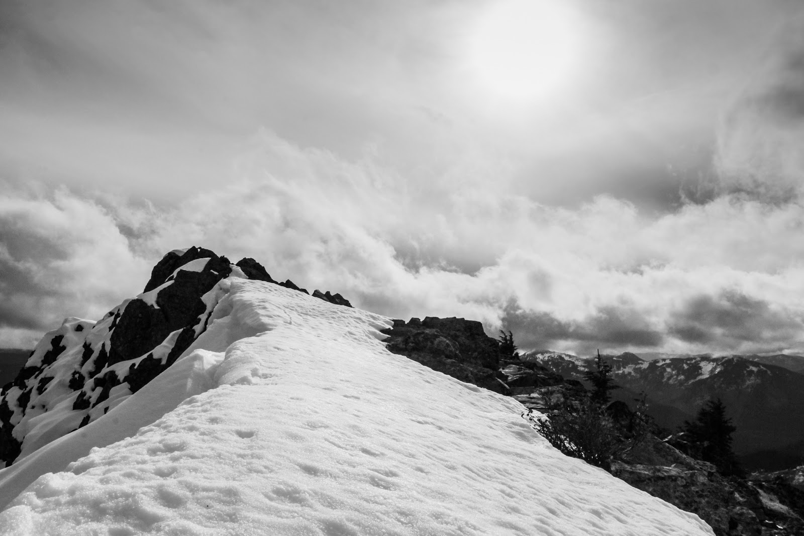
| the last bit of ridge walking to the summit |
I topped out a bit early and had to traverse the ridgeline for a few hundred feet, but it was not nearly as bad as further below on the N. ridge. I took a bunch of pictures of all the nearby peaks in their new snow cover (probably all gone now a few weeks later) and then headed down.
 |
| Red mountain, obviously. |
 | ||
Thomson! High on the list. Route looks snowfree here! Should have daytripped it
|
Once on the trail I stashed my camera, buttoned down the pack and ran most of the way back to the junction with the climber's trail. The PCT was perfect for this - a gradual downhill made for an easy quick jog. I took the cilmbers trail down, and took a quick left off it, hoping to get down to the creek and eventually find the log crossing we've used in the winter. I'd have to cross the creek at least once to get in the middle, however, before taking that log crossing out near the end of the trail. The trail petered out at some point and I ended up having to schwack a ways downstream before eventually crossing and finding a good path on the North side of the southern most creek (it's a maze in there). I'm sure this path connected somehow with the turnoff from the PCT further upvalley from where I schwacked. Following the trail downstream, the log crossing soon revealed itself, and I knew I was home free. Another mile or so of steeper downhill and I was back - a beautiful day in the mountains for late October!