Showing posts with label rock. Show all posts

Saturday, May 25, 2013

May 25, 2013 - Burgundy Traverse

Memorial day 2013 had long been planned as a time to try the Isolation traverse with Skye and Greg, who flew in from sunny San Diego. Skoog's sentiment that you can plan where you want to ski or when you want to ski, but not both proved true enough, as the weather forecasts consistently showed rainy weather, and even NWAC weighed in at the end of May due to new snowfall up high. As the isobars aligned themselves against a foray into the high alpine, we plotted our recreational weekend through the murky WA spring weather.

Movie shows a SilverStar Mtn heavy overview of the weekend:


Burgundy Traverse from Erik Turner on Vimeo.


Instead of a full on traverse we opted for rock climbing down low punctuated by ski day trips when the weather might cooperate. So it was that we headed off to Leavenworth on Friday after a half day of work ready to dial in our 3 man multi-pitch rock climbing system for a hopeful assault on something on WA Pass if the weather allowed. Catapult to Canary offered up 6 total pitches of excellent climbing and a kicked the weekend off in the right direction. We used 50m half ropes, with the leader tied into both, and the followers each on one rope. This seemed like a great idea until I fell a few times at the crux pullover on the top of Canary... everything worked fine - thin ropes with a autoblock ATC guide belay... but it felt a little odd to see that little rope drag along the rock edge above me! But before we got up to Canary, I led up a wet and awkward 5.6 chimney.... and I'm glad I did, as this allowed Greg to lead the money 5.8 crack pitch above. He cruised it, and Skye and I did our best to hurry up to the belay. A little mixup ensued here as we swapped ropes around for Skye to lead on. Worst of it was myself unclipping from the only rope that was holding me to the anchor for a brief moment - very stupid. I think our system worked well with everyone tieing in with lockers on fig-8s on bites to allow for quick changes (all 3 of us wanted to lead). The key seemed to be, like always, put all your personal connections to anchor below everything and flake the two ropes out on each side.

 Here's how we eventually settled into our pace:


  • Leader leads up on twin 50s. Belays off anchor with ATC guide to allow two simul followers.
  • First follower climbs up and cleans (leaving minimal directionals as needed). Once at belay takes all unused gear. The rope they are attached to is already flaked correctly. 
  • Second follower comes up and attaches in with PA or runner. Then hands their tie in to the new leader, and takes a tie in from the old leader. Now all ropes are flaked correctly. The trick is to change the tie ins without further entangling anything. 
  • Next leader is ready to climb on. 


    Skye cruised the last pitch on Catapult, and we walked around to Canary. We again handed the sharp end to Greg for the money first pitch, as Skye and I have both previously lead it. Appreciative of the top rope on the runout textured start, I cruised up to the top, where I became a bit pumped when feet run out and you need to just heave it over the lip. My third heave allowed me to shimmy my way onto the ledge and begin to collect my nerves for the next pitch.... and particularly the step across. Once good hands are found, I stepped out into the void above the entirety of the last pitch... probably about 90' of air below your feet.... and a seemingly awkward fall, as the bolted belay is way off to the right, and you'd fall down and have to reclimb the muscly moves at the top of the crack pitch. It looks and feels exposed, but the climbing was easy. Not easy enough to just pull through, though, as I placed a #1 in the horizontal crack before pulling the remaining half move necessary to reach the bolt on the arete. From here the pitch was a maze of climbing up textured rock with more horizontal cracks. It was a bit confusing to me to be both looking for the next bolt or pin to guide you, but also seeking out places to place gear. Thinking I didn't want to get so high as to not be able to hear Skye or Greg as they did the step around (and risk pulling up slack and pulling them out a bit when they are over the void) I built an anchor in a small ledge overlooking the Tumwater and Skye and Greg both stepped out and followed up. Again Skye led the top out pitch as we came out on top of Castle Rock, took a few pictures of the now waning light, and headed down the approach trail down to the car. 

    Since we weren't doing a traverse, or at least a ski traverse, we decided getting food in town instead of cooking that night was warranted, so we did the traditional Leavenworth thing and got some veggie brawts in town. Finding camping now was a bit complicated by nightfall and the holiday weekend. We found our favorite spots along Icicle canyon taken, and drove further and further out until we finally Subaru schwacked down a lightly used grassy road and collapsed just behind the rocks that barred further progress. Instead of the soothing gurgling of a stream, we listened to unseen neighbors camping elsewhere in the woods. 

    Saturday. Classic flow day. 
    We woke and climbed a few cracks at Eightmile rock before taking off for Twisp and the dry forecast for Methow valley. Classic crack lived up to its name, and I enjoyed the jamming immensely...It was the first time I really torqued my hand over in a crack and pulled down on it with full body weight. Exciting. The drive to the Methow took most of the afternoon, and we arrived just in time to eat at the Cinnamon Twisp before driving up the Chewuch River Rd East and finding a money spot along the creek. Some timelapses, beer, campfire, ICE, and we were off to sleep. The weather was looking good, and forecast to be decent the next day, so we opted to try and ski Silver Star, in keeping with the tradition of doing only things Skye had done previously.

    Blue sky starting to poke through - time to head up into the mountains!

    Sunday. Up into the alpine!
    The alarm went off but I swore it must have been late - it was light out and birds were chirping... no, it's just June in the PNW, when the sun rises at 4:30AM, seemingly. We shoved in food, hastily stuffed our sleeping gear together and into the car, and off we drove up the road to Silver star creek. As we pulled in there was a bus with a trailer in the trail head - sweet! someone else thought this was a good idea too, and they travel in style! We walked up the heavily forested approach where we all learned and relearned exactly what size gap between trees you could shoot through with ski boots sticking off the sides of your pack.

    Silver Star Creek and Greg finding some trail


    A few miles and several thousand feet up we finally broke out onto a boulder field and saw the dreary gray clouds up above - not promising! But at least it wasn't raining. As we climbed further up in and out of the progressively thinner and shorter forest, we were passed by some fast moving Bellingham skiiers coming up behind us. The next few hours of routefinding in the gradually more alpine terrain was eased greatly by following their tracks, around left of the steep forested cliffband instead of right through the ramps of the main drainage. While the right hand variation looked good when snow was deeper, I think we choose wisely to follow to the left. We skinned up a finger of snow  and eventually below a waterfall before traversing over to the broad benches below the slopes leading up to the summit col. It began to snow and visibility dropped as we skinned up the steepening left gulley.

    Greg gaining the bench

    views up toward Vasiliki ridge
    Our skintrack winding through the high alpine environment... just before the steep gully
    Many larches were out - looking forward to looking down on them from the top of a tower in the fall!
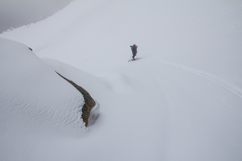
    After gaining the large bench above the gulley all 5 of us hung out for a while and threw down some food and water while we waited for the visibility to improve. It didn't, so Skye plodded on upward anyway, seeking out the col, while I followed, skinning along and checking the GPS to ensure we didn't walk up to the col and a possible cornice.

    poor visibility for the upper part of our climb


    Skye leading the way up into the mist


    First winter ascent in May.


    Some final steps up to the summit


    off-width...... arm bar, chicken wing..... ski boot!

    Turns out the col was very mellow and we popped out, ditched skis and then transported ourselves back to January to wallow through ~ 1' of fresh powder to reach the summit block. A fun off width move led to a short traverse and Greg alone made the exposed move to throw him self saddle style upon the summit. I relished in the surroundings, and was satisfied enough with touching the summit rock. Back down at the notch below the offwidth we enjoyed some whiskey, remembered friends, and then walked down to our skis.
    looking back down on the ski depot
    Patagonia?


    The skiing up high was excellent - wasn't quite face shots in May, but it was damn close! Low visibility meant we couldn't fully open up on the upper slopes, but soon enough we poked below the chilly cloud layer and were out into the open. Snow quickly became softer and sticker, eventually become saturated enough lower down that it again skiied fairly well.

    Pounds abound for the skiing, not so much the slog out from here...

    The views FINALLY open up right before we duck into the woods. Thank you for that moment, weather.


    The good skiing was over too quickly, and soon after skiing the fall-line through the steep gully, we just traversed high along skiiers right and hugged the snowline all the way out to the waterfall, and down a few hundred more feet of slushy snow before sliding along through rock studded portions on the valley floor. Once we reached the woods we switched back over to booting and enjoyed the schwack through the forest before finding the trail and heading back out to the car.
    Greg and Vasiliki ridge in the background

    Just as we set our gear out and were enjoying some well earned beers, the rain started up again and we quickly shuffled our stuff back into the car and drive down to Mazama and to the Ballard campground along the river. Our car exploded with wet gear all over the rocks and picnic table and we enjoyed a roaring campfire late into the night. The weather didn't look great for being in the alpine the next day, so we decided some cragging above Mazama was in order.

    Monday - Mazama, the WA Mecca
    We enjoyed two stops at the famous general store on the way in and out of Mazama, with some rock climbing up on Sun Wall. Despite our climbing Sun King and willing the rainclouds away, after 3-4 climbs the skies opened up even down in Mazama, signaling that we needed to take off. A quick packup in the car and we were off on the scenic drive along SR20 back to Seattle.


    Greg putting up the rope on Plexus on Sun Wall. The wall lived up to its name until it started raining.


Saturday, March 30, 2013

March 30 2013 - Mt Thomson #1


Our route up Commonwealth, over Kendall Catwalk towards Thomson and out Gold Creek. A better exit sketched out going up Silver Creek and out to Commonwealth directly... next time!

Mt Thomson NE of Snoqualmie has been on the list ever since I saw pictures of it a few years ago. With a moderate 5.6 rating and amazing views into the depth of the Alpine Lakes Wilderness, it makes for an excellent climb.

Garrett and I hemmed and hawed for a while about the best approach for the climb, and finally landed on a single day push to move light and fast, unencumbered by overnight gear. We left the Commonwealth trailhead under wonderful weather at 5AM.

gearing up in the AM

The going was very easy in the tracked out path up Commonwealth, and for the first time we did not cross at the log bridge, but kept going up the south / east side of the creek up towards the NE corner of the drainage. Luckily a skin track was going just where we needed it all day long, not too uncommon in this area, but we didn't think we'd be so lucky! It was especially nice to have a flat platform skintrack on the switchbacks up towards the col shared by the PCT as it snakes past Kendall.


gorgeous moon setting

There are two snoqualmies. The moderate slopes facing the highway laced with lifts, and then there is the backside gnarliness. Snoqualmie seems to me a western town with a veneer of mellow slopes on the highway side and gnarly chutes just around the corner.

Once we topped out on the col - our timetable began to disintegrate. The next few hundred feet north along the ridge would not be easy going, and would have to be "quickly" pitched out. Drinking in the beautiful scenery as we set up an anchor was consolation for time flying by. I led across the snow traverse which was most sketchy at the beginning where only ~6" of slushy heavy snow clung to the slabs that perched above cliffs.

leading across the Kendall catwalk


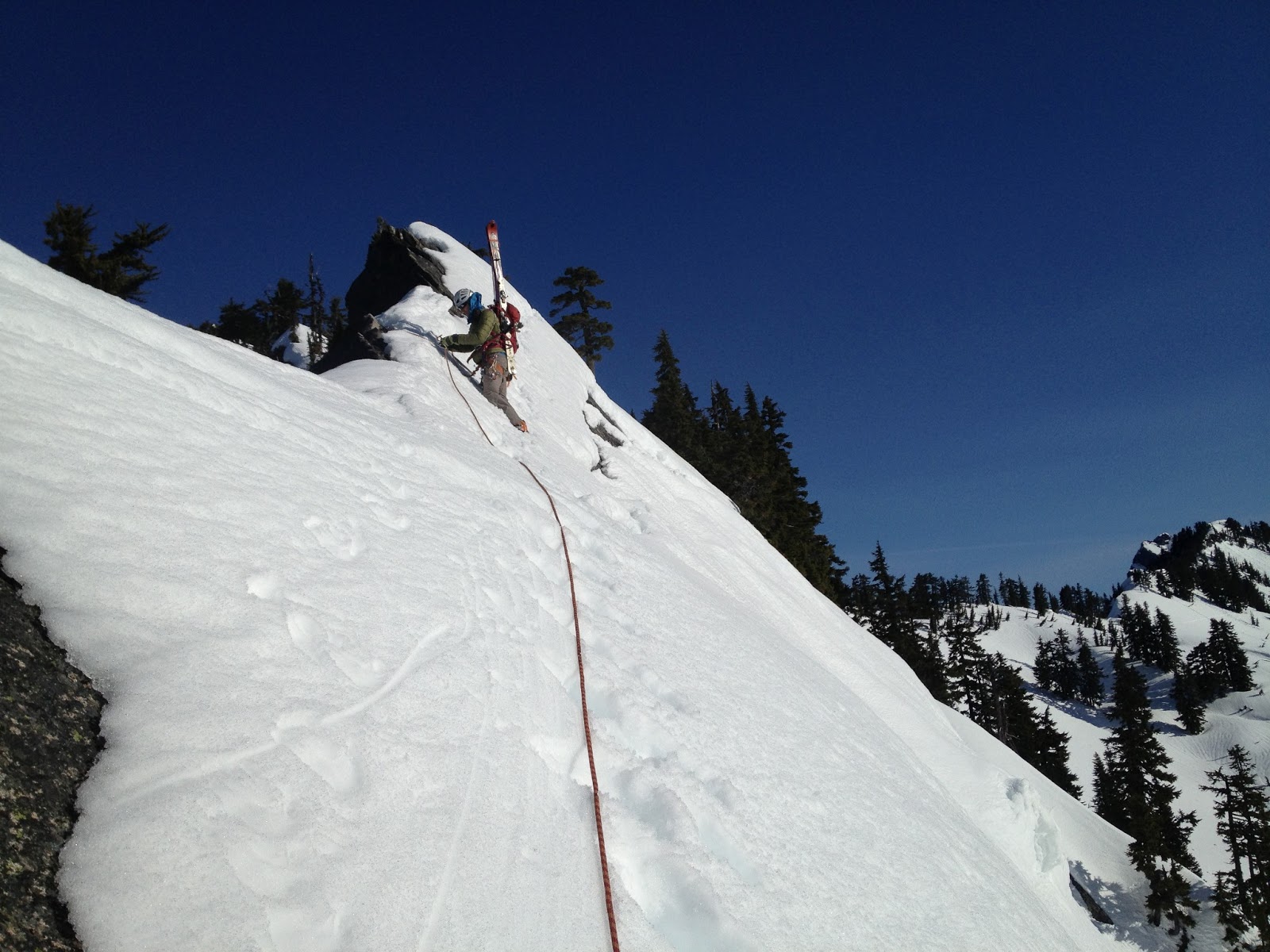
One solid cam placement kept me happy, but as I edged away from it and my crampons continuously scraped, I was wanting for some firm foot placements. After setting myself up for a fall long enough to go over the cliffs below, the firm snow finally materialized and I quickly bootpacked it up to a tree to sling and bring Garrett up. Following cautiously, he came up and came past to finish our traverse from the catwalk after an intense effort of ski / tree anchor yoga to get the rope from my left to right side over my pack with skis on it. Those K2 Shuksans are designed to grab ropes, I swear.


Looking past the catwalk at some gnarly terrain
North Cascades or Snoqualmie Pass?


From here on we continued to follow the skintrack that led us quickly down to Ridge Lake. We met up with the guys who had set the skintrack - they had come up the evening before and camped at the col by the catwalk. They too had their sights set on Thomson but after a long slide / fall down the face traversing Alaska, they had retreated to the saddle and were thinking options to get out. Not wanting to bail on the climb before we had suffered further, Garrett and I pushed up the alternate entrance to Bumblebee basin - the col NE of Gravel Lake.

Looking up the face after picking our way back down


There was a good amount of small avalanche debris littering the face - likely from the late afternoon the day prior. As we traversed across and eventually booted up steep sections between small cliffbands, though, stability didn't seem like an issue. The southwest aspect of this face meant it would only really heat up in the late afternoon. At 12:30 once we had reached the top of the ridge we could see down into Bumblebee basin, and a bootpack route to the base of the climb. The hour was too late, however, and we decided to head back.


A tree near Ridge Lake provided much needed shade


backside of Red Mountain with a giant cornice on top
Rainier and some of our route from Kendall catwalk


snow shapes


Neither of us wanted to reverse the catwalk section after it had had more time to slush up and prepare itself for sliding. We had also both heard of horrible exits out Gold creek, but considering we hadn't ever gone up Silver creek before, Gold creek became the only reliable option.

Once again we found a skintrack to take us up out of Ridge Lake - thanks to the folks ahead of us!


Garrett topping out with some great scenery behind

We dropped back down to Ridge lake, cut across the ridge above Alaska Lake and skiied down for a few thousand feet in mellow treed east facing slopes that held decently good snow....bonus! In our excitement upon finding carvable conditions, we skiied a bit too directly down and found our selves in some more committing terrain than we had hoped for. After carefully picking our way through cliffbands and wet slide runouts, we finally crossed Silver creek and came to a stop near Gold Creek.... all we have to do now is follow the creek out, right?

Skiing wasn't bad!

Last turns. Looking up towards Silver creek basin... we continued down and out Gold Creek...


For miles and miles we followed the creek... crossing and recrossing when the conditions appeared better on the opposite side. Comical attempts to "read" the skintrack language of... "did they turn back and go that way" or "did they continue this way?" usually just wasted time. The best option seemed to be follow a track blindly until it turned around on you... then swear and follow it back to the junction and choose again.

...crossing the creek...


Hmmm which way?
...crossing the creek again...

Tree and Silver Peak. I was thankful to start seeing familiar terrain as the sun went down...


We eventually felt the valley starting to widen and cabins began appearing. Night had now mostly fallen as we skiied around a large lake, and then had to traverse right back over to the east side of the valley in order to catch the main road out. Hearing the loud rumble of tractor trailers was never so sweet, as we finally donned approach shoes and walked the road beside the buzzing traffic. We needed to get a further 2 exits down the highway, and that wasn't happening on foot this night. Luckily the WSDOT came through in the clutch and obliged the desperate request for a ride over to Summit West.

Booting time!

Just a stroll along I-90 left

Night photography while walking with a point and shoot.
Thankfully we eventually got a ride from Hyak to West

Many lessons were learned on this trip. Going in or out of Gold Creek will be avoided at all costs. During this time of year with rapidly changing snowpack, it may be unwise to try and day-trip a climb that features a prominent south slope bootpack to access the base. A camp in Bumblebee basin with an alpine start on the rock and an exit early enough to avoid south slope shenanigans seems to be the way to go. Or just waiting for summer.


Sunday, October 7, 2012

October 7, 2012 - Vesper Peak North Face

The beautiful late summer continued to encroach upon fall in the pacific northwest. The north face of Vesper had been on the list for a while, so Nicole and I took the weekend to carry our packs into the basin below Vesper and camp, and climb in the morning. 

Our route and some beta for approach. Go up standard E. ridge scramble route and cut North at 5800'
This was my first time out on the Mountain Loop Highway, I thought, until I recognized the Lake 22 trailhead on the way by. So... new territory once we passed that! Nicole had recently been up towards Del Campo, and her report back of how nice the views were prompted Vesper being moved to #1 on the list.

The approach was straightforward. The only beta for the trail approach we had was that Headlee Pass was hidden from view until you are right up on it, and indeed it was! Only as we pulled directly up below the tightly switchbacking trail were we able to figure out exactly where this trail meant to punch through the craggy skyline above.


Nicole crossing the talus field beyond Headlee Pass

Rainier in sunset light
We made camp along the east ridge of Vesper just after the creek crossing. We lounged around in camp and made plenty of food. I had carefully planned out a star timelapse, but was stymied by my intravoltemeter running out of batteries - bummer! The stars were quite impressive none the less. 


Planning for the next day, I severly overthought the approach to the class 4 traverse that leads to the beginning of the climbing. Figuring that we needed to drop to the lake before climbing up to the correct notch, I unintentionally got us a bit off course...We climbed up a rocky face above the lake only to find a snow slope without any mark of human travel. No prints from the groups we talked to on their way out yesterday... uh oh. The snow was very low angle, but was bullet proof, and we didn't have crampons or ice axes. The run out wasn't bad, however, so we slowly worked our way up, using the suncups as steps and our poles as wanna be ice axes. Eventually we gained a notch in the ridge, but unfortunately we were one bump away from the beginning of the traverse, so we scrambled some rocks on what is likely the standard Vesper - Sperry traverse route.

Our route up in red and down in blue. Follow the blue up and traverse on the pink (5800') to avoid our poor approach!
Nicole making her way up to Vesper - Sperry col

Nicole embracing the easy approach we though we would have

Moon over rocks
Eventually we got back on track and started the traverse, which is billed as 4th class by none other than Fred Becky. Knowing this... I fully expected we'd be roping up at some point before heading upwards. I didn't think, however, to keep a keen eye out for a footpath at the first sign of difficulty, and after 20+ minutes wasted in a poor simul-traversing botch, I looked down and noted an easy footpath below us. Reverse simul and down to the path and we scrambled as far west as we could until we felt the need to rope up.


The first pitch was certainly still part of the "traverse" that some parties undertake, as I climbed up one 20' section of easy open book, then ran it out as I walked on ledges trending up and right. I stopped at one of these ledges knowing that I couldn't pass over the whole slab that lay above and to my right with the remaining rope. Built a solid anchor (this trend wouldn't continue) and brought Nicole up.

Looking back down the first pitch with Glacier Peak in the distance
The second pitch started up the unprotectable slab and aimed for a weakness in the "roof" above that lay between us and the upper North face. it was rather easy to walk some ledges up through the roof instead of doing any serious climbing, and protection was there when needed. Once up past this small roof, however, the slabby nature quickly took over again and there wasn't much pro for a while. As I neared the end of the rope length once more (thanks radios) I pulled over one more ledge and found virtually NOTHING with which to make an anchor. All smooth folds of rock with no cracks... nothing to sling. The only piece I was able to get in was a small nut, but the direction it was in wasn't all that inspiring for belaying a follower. As I searched around in the vicinity of the nut placement, I found a tiny fissure in which I was able to jam a purple Metolious #0cam into, and a secure tug seemed to reassure. However by far the best piece of this anchor was the third one - as I sat back into the slightly incut ledge, I braced my feet high on the lip and cammed myself into the rock. Three on a rope style! I slapped in a Munter and brought Nicole up, who thankfully followed with no issues, though I'm rather sure I could have held her just fine.


Looking up at the final 1.5 pitches of open book climbing. 4 star!
After Nicole came up, we both walked a bit up and left on this large ledge and set off on the final 1.5 pitches of climbing to the summit. This is what we had come for - amazing slab with a great open book crack running the whole way up. It reminded me of Diedra at Squamish. The first pitch off the ledge was a bit tricky to start and I threw in almost a third of the cams in our alpine rack in the first 4-5 moves, but after that it was cruiser and I thought very little of placing every 20'+. Eventually the rope ran out and I built an anchor conveniently enough at the next opportunity. I had actually run out of larger cams for the diehdral crack already, so used some smaller cracks in the wall off to the left.

Looking down from the last belay station
Nicole followed up and really seemed to be enjoying herself. Unfortunately the crowd that had peered down upon me as I had worked out dissipated, likely looking to casually stroll out to the cars before dark! Before I knew it I was taking the sharp end again and running all the way up to the ridge crest. The last 30' of slab was gravely overgrown with lichen and moss, so instead I climbed directly up left on some loose crap. I even took a bit of a slip, but was able to hold it before weighting any pieces. Once off the rock I had to walk up some steep annoying grass before I could build a decent anchor. I then radioed back to Nicole, through the chatter of the zipline operation who seemed to be sharing our station, that the belay was on.

Me: Nicole, belay on

Random dude: Carol is strapped in... wooeee! zip away

Random dude #2: Allright Carol, we'll see you at the bottom

Nicole: What??

She eventually got the message, and I found out later that the real holdup was trying to unjam a cam from the anchor, which thankfully she eventually got loose.

We lounged on the summit and enjoyed the late summer sunshine. New forest fires had sprung up between us and Rainier and it was interesting to see the smoke plume rise up and then get abruptly sheared off towards the northwest.


The snow was much softer and easier on the descent
We made quick time of the descent, and packed up our camp in record time before bounding down the path to Headlee Pass and out to the car. A great trip which also served as inspiration to come back to this beautiful area. Vesper is a common spring ski tour... but I think it would make a worthy winter summit as well... Vesper Glacier tour, anyone?? Circumnavigation of Big 4 Mtn?

Ascend to Hall Peak / Big Four Mtn col. Drop down through likely thickly wooded and steep slopes towards outlet of  Copper Lake. Skin to base of Vesper Glacier (name?) Climb and set up camp at notch where traverse starts for N. Ridge routes. Ski back down glacier and reclimb :) Second morning traverse over and drop overnight gear along E. Ridge and climb up Vesper and ski down to pick up gear. Then ski out via Headlee Pass and Sunrise Mine trail road to Mtn Loop Highway. Would have to be able to drive in this far on the loop highway, so not sure if this is doable in deep winter??