Thursday, July 11, 2013

New site!

*Edited in 2022* Oh times and websites have changed. The link below is way past dead, and all backups to that site are unfortunately lost to the sands of time (even the waybackmachine doesn't find it). Alas, there are still some cool trips on this site, and I'll upload our 10th anniversarry trip here in a nod to echoing our honeymoon trip. 

So I'm once again stepping outside the limiting confines of google's blogger looking for a better platform to toss up photos, stories, projects and trip reports. Going forward, I'll be posting up to:

http://www.highpressurephotography.com

I'll slowly be porting over the existing reports and photos from this site to have a full archive over there... but for now - check it out - it's mostly built up....

Saturday, June 8, 2013

June 8, 2013 - Baker North Ridge


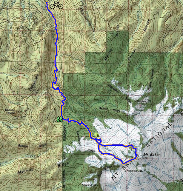
Our overall route up the Glacier Creek Rd and up the summer trail

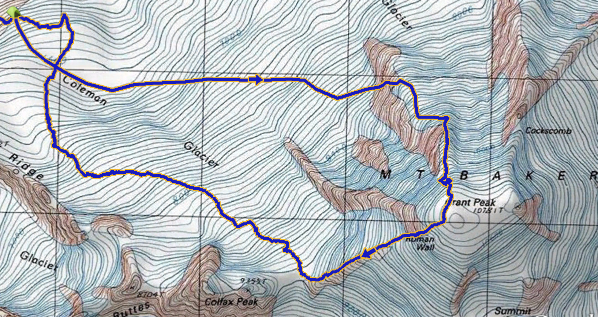
Our climbing route across the Coleman Glacier, up the North Ridge and back down the Coleman-Deming route

The north ridge of Baker had been on my list for a while as a moderate ice climbing route on a big volcano. I was excited enough about the route to not blink an eye at the 7 mile, 2500' gain bike approach to the trailhead over the now closed Glacier Creek Rd. Actually the closure probably made our climb more enjoyable by keeping the masses off the Coleman-Deming route.

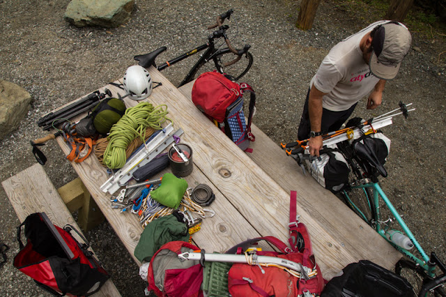
On Saturday we took off from town with all our gear packed up in panniers and bikes strapped to the roof of the Subaru. After turning off onto Glacier Creek Rd we drove the 2 miles to the road closure and then started the process of attaching all those heavy bags to the back of our rides.


All geared up ready for the bike approach
The road was certainly more steep than I remember from driving it, but my 39x27 was enough to get me all the way to the trailhead. I certainly cut my fair share of switchbacks up the steep sections of pavement, but the road is in great condition given some of the other forest service roads out there. We were crawling along, though, as the 7 miles of road took about 2 hours to cover.


Resorting gear for the approach to camp
The hike into camp went fairly smoothly and we found ourselves with much of the afternoon to relax, enjoy the "mostly sunny" weather that was rolling in and out, and practice some crevasse rescue. As the light slowly faded, we all passed out with an early morning wake up in order.


Camp at 6200'

Slopes above camp

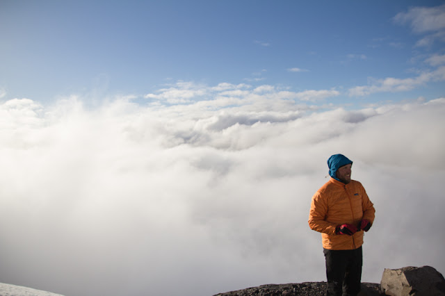
Bryan enjoying the views from camp, which were great when the clouds actually opened up


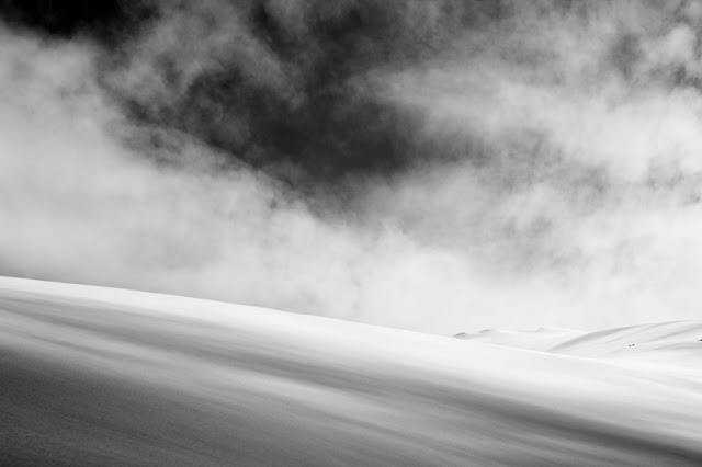
Clouds billowed in and out throughout the evening, only clearing overnight.

Bryan and Garrett passed out well before sunset, but owing to the fact that I brought up a tripod, I didn't have that luxury. I set up my bivy, dialed up a little fire in my buddy burner, and hung out and watched the light show. The sea of clouds provided some excellent sunset conditions, but the clouds rolled in thick once it got dark. I got a little bit of shut-eye, but was awoken by the sensation of clear sky above, and indeed a few hours into the night it had cleared up and the stars were out in full force. I did my best to setup a composition including the BD tent Bryan and Garrett were in, and fell back asleep to the sound of shutter clicks.


Sunset clouds and Koma Kulshan stars from Erik Turner on Vimeo.


We got up and moving by 5:30, behind a group of two going up the Coleman and a group of 4 going up towards North ridge. The group of four started out as small dots, but as we worked our way through the crevasses of the glacier and up towards the ramp taking us up to the ridge, we found ourselves right behind them. A bit of jockeying took place, and they picked up their pace just enough to get to the ice pitches before us, so we made an anchor of sorts and hung out for about an hour as they started up the first pitch.


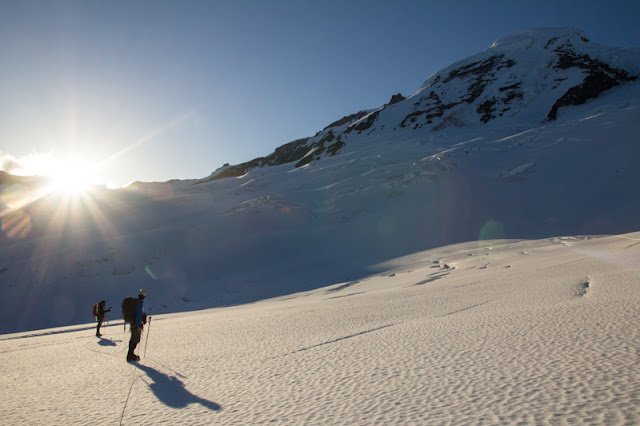
Early morning light on the glacier

Refrozen wet slides - probably from the Memorial Day storm cycle

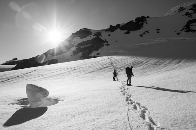
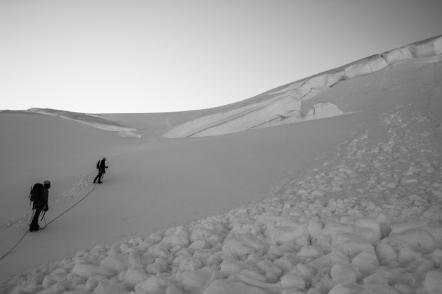
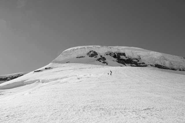
Four dots ahead starting up the ramp

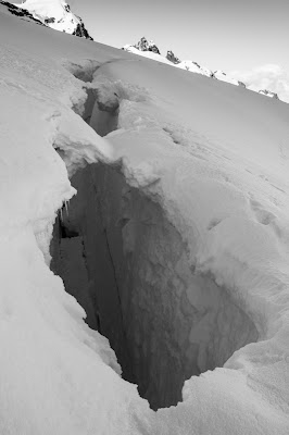
Large crevasse, thankfully well bridged

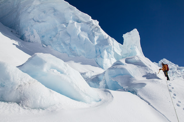
Looking up at the ice pitches left skyline is "left option" whereas climbing up near the rocks in the center of frame is the "right option"

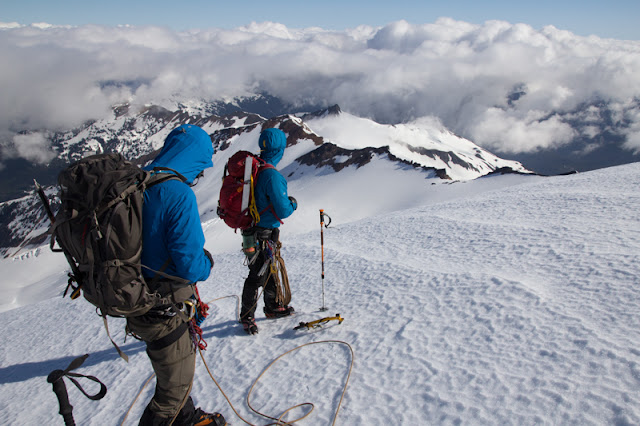
Checking out the view to the north from the ridge

We made a short pitch out of getting into position behind the first group, and waited as long as our patience would allow. Finally Bryan went up hoping to find a line next to theirs and get us moving again. After pulling over the lip, though, it was clear the most straightforward path lead right up through the group, and we had to wait behind as they all finished up and gained the hard snow pitches above the ice.


Bryan setting up the first anchor after trying to climb around the group in front of us


Garrett pulling the crux of the second pitch

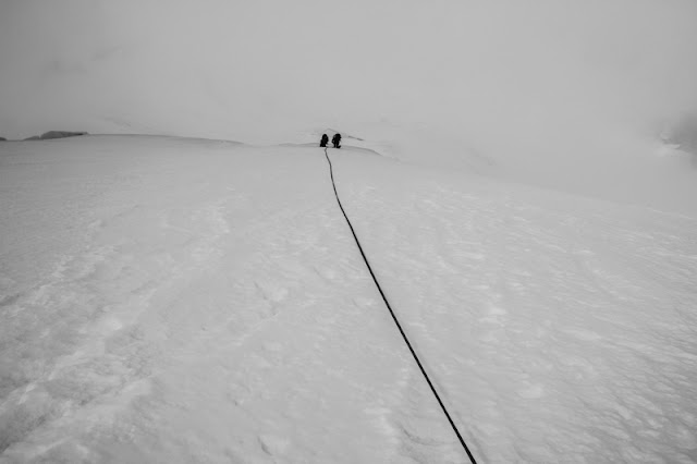
Several pitches of hard snow ended when we got tired of moving at "pitch it out" speed


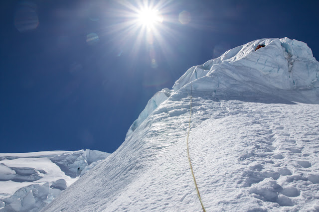
The final difficulties involved weaving through this serac garden, and then stepping across a few cracks to gain the final snow slope. The seracs were even more beautiful around the corner, but I felt that lingering for too long was a bit risky...

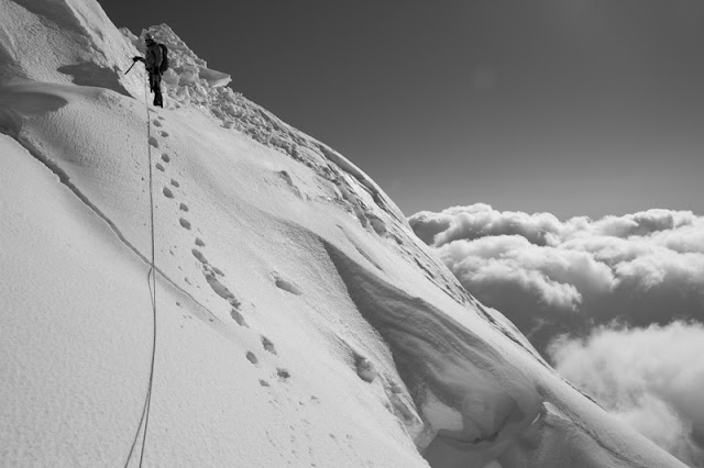
Sketchy snowbridge high up on the ridge

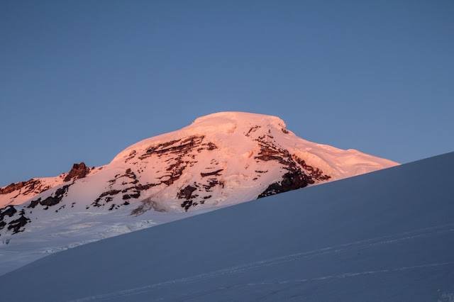
Alpenglow was gorgeous, but it was getting a bit late to still be on the glacier...

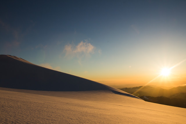
Beautiful sunset on the Coleman glacier

With all the delays on the ice pitches, and our slow progress on the snow slopes above, we found ourselves on the summit at around 6:30. The only other time I had descended the Coleman-Deming was on skis, so the long flat stretches on the lower glacier seemed to last forever as we postholed along. After a while the top surface of the snow started to freeze over and postholing in soft snow yielded to postholing through breakable crust. We finally got down to camp, packed up and hustled out the summer trail with headlamps. The bike ride downhill wasn't as sketchy as I had feared - only the first gravel patch caught me by surprised and caused me to crash. My former bike handling skills came in handy as I dispatched the fall with a somersault and was off again down the dark road.


Saturday, June 1, 2013

June 1 2013, Mt Shuksan


Route up Sulphide Glacier; camp at 6400'


Google Earth view of our route
Northern Picketts from Sulphide Glacier


Last year at the end of May we attempted Mt Shuksan, and were shut down due to getting up to the pyramid a bit late, and the soft snow zapping the energy from the bootpackers in the group. This year we aimed to have everyone on skis, set a higher camp, and get up there a bit earlier. 

We started on Saturday AM from the Shannon ridge TH, which was easily driveable, in contrast to last year where we added ~1 mile of road walking to our trip. There was also less snow up on the trail, as we walked up to the third switchback of the summer trail before hoofing it up the snowslopes to gain the ridge above.


Nicole and Erika heading on up through the trees

Lunchbreak under the tarp - this setup was just practice, but it was put to good use soon after!

Mt Baker hiding behind stormy clouds

Two climbers high up on the Sulphide glacier (view from ridge below notch). Climbers are on slopes above the 6400' bench.

We lucked out for a while with the weather...

...but soon ridgelines started to disappear into grey...


Nicole and Erika making their way up to the notch. Baker Lake and weather behind.

Pulling up to the notch just in time to catch a rainstorm

We huddled under the tarp to keep drive in the intense but short rainstorm that passed through. The UW model proved fairly accurate with its midafternoon system moving through and then general, slow, clearing...

cleared up enough for a rainbow


Never get sick of these peaks above the notch. Would be good alpine climbing practice to traverse them.... next year!

Traverse track from the notch around to the Sulphide Glacier

Bryan leading the way across

Nicole stomping out a skintrack

Clearing skies as we climbed the slopes up to 6400' camp

Upper route shrouded in clouds for much of the late afternoon

Camp. I love camps with views of starry skies...

Good morning Baker - you can see tracks starting from the lower left - up the Boulder glacier

Little snow peak above camp

Summit pyramid visible from camp

Sunrise provided some amazing light as we prepared to head up to the pyramid
Nicole getting ready

It looks so close, but still a few hours away!

High on the Sulphide glacier

Footsteps from prior climbs

Northern Pickets from high up on the Sulphide. Mt Challenger is the largest peak on the left - its namesake glacier shrouded by clouds from this view. Phantom Peak is the high point on the right.
amazing scenery

Mountains and clouds

Looking back down on camp (We are the two BD tents center left. NOLS group above us)


Nicole booting up the slopes above camp


Nicole climbing through the upper Sulphide

It's getting closer! The debris at the bottom of the gullys had us concerned...


Bryan taking in the views


Nicole topping on on the steep slopes above camp

Clicking back into skis for the long slightly uphill traverse to the base of the climb

Getting there

Climbers on top - jealous!

We watched them pitch out walking down the gully. They didn't appear to have much trouble, but did take their time, which was another reason we went over to the ridge around to the right.
Upon reaching the base of the pyramid, I pushed up onto the notch on the right hoping to get a view around of a scramble route to the top. It wasn't promising, as exposed rock moves with downsloping slabs and partial snow cover would make the climbing committing. We hadn't really prepared for a full on technical climb on the pyramid - just a few pieces of rock pro to back up raps if we needed to. Bryan scratched a ways up and checked out the route before pulling the plug on trying the ridge. Being that it was only 11AM, I wish we had taken a shot at going up the gully, but we were afraid that the detached rime ice that was prevalent everywhere would start raining down once the sun really started to work on the upper pyramid. Looking back now I think we would have been OK to shoot for it, and should have just taken a rope up to have a belay down for Nicole as we worked our way down. I was fairly bummed about being shut down again, but now we have an excuse to try an April Nooksak traverse trip... Baker ski area to Mt Shuksan via the White Salmon, then traverse out below the Nooksak ridge before climbing Ruth and Icy and out Hannegan Pass TH. More likely for the gully to be fatter and better for skiing then too!

We flipped it and started out ski down, enjoying lots of consolation turns on the way down. Up high the conditions were great corn, though the visibility kept us from being able to open it up too much, it was difficult enough just staying together.


Bryan about to ski the last slopes down to camp
Back at camp we ate some more food, hydrated and started the packup for the long ski and walk out. Despite the thick heavy snow below, I only wiped out once, in spectacular head over heels flip action. The tripod and random junk I had tacked onto the outside of the pack all made the flip with me, though!

And the timelapse turned out OK - was a bit cloudy in the middle of the night, and the method I was using to transition from night to day has still left some significant flickering... more practice needed there! Also think the tripod sunk into the snow as it was warmed by the sun in the morning... will need to fabricate some metal clamps to attach to the legs.... or maybe some sort of repurposed snowbaskets...


Stars over Shuksan from Erik Turner on Vimeo.