Showing posts with label cascades. Show all posts

Sunday, October 7, 2012

October 7, 2012 - Vesper Peak North Face

The beautiful late summer continued to encroach upon fall in the pacific northwest. The north face of Vesper had been on the list for a while, so Nicole and I took the weekend to carry our packs into the basin below Vesper and camp, and climb in the morning. 

Our route and some beta for approach. Go up standard E. ridge scramble route and cut North at 5800'
This was my first time out on the Mountain Loop Highway, I thought, until I recognized the Lake 22 trailhead on the way by. So... new territory once we passed that! Nicole had recently been up towards Del Campo, and her report back of how nice the views were prompted Vesper being moved to #1 on the list.

The approach was straightforward. The only beta for the trail approach we had was that Headlee Pass was hidden from view until you are right up on it, and indeed it was! Only as we pulled directly up below the tightly switchbacking trail were we able to figure out exactly where this trail meant to punch through the craggy skyline above.


Nicole crossing the talus field beyond Headlee Pass

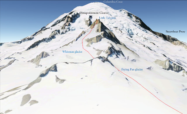
Rainier in sunset light
We made camp along the east ridge of Vesper just after the creek crossing. We lounged around in camp and made plenty of food. I had carefully planned out a star timelapse, but was stymied by my intravoltemeter running out of batteries - bummer! The stars were quite impressive none the less. 


Planning for the next day, I severly overthought the approach to the class 4 traverse that leads to the beginning of the climbing. Figuring that we needed to drop to the lake before climbing up to the correct notch, I unintentionally got us a bit off course...We climbed up a rocky face above the lake only to find a snow slope without any mark of human travel. No prints from the groups we talked to on their way out yesterday... uh oh. The snow was very low angle, but was bullet proof, and we didn't have crampons or ice axes. The run out wasn't bad, however, so we slowly worked our way up, using the suncups as steps and our poles as wanna be ice axes. Eventually we gained a notch in the ridge, but unfortunately we were one bump away from the beginning of the traverse, so we scrambled some rocks on what is likely the standard Vesper - Sperry traverse route.

Our route up in red and down in blue. Follow the blue up and traverse on the pink (5800') to avoid our poor approach!
Nicole making her way up to Vesper - Sperry col

Nicole embracing the easy approach we though we would have

Moon over rocks
Eventually we got back on track and started the traverse, which is billed as 4th class by none other than Fred Becky. Knowing this... I fully expected we'd be roping up at some point before heading upwards. I didn't think, however, to keep a keen eye out for a footpath at the first sign of difficulty, and after 20+ minutes wasted in a poor simul-traversing botch, I looked down and noted an easy footpath below us. Reverse simul and down to the path and we scrambled as far west as we could until we felt the need to rope up.


The first pitch was certainly still part of the "traverse" that some parties undertake, as I climbed up one 20' section of easy open book, then ran it out as I walked on ledges trending up and right. I stopped at one of these ledges knowing that I couldn't pass over the whole slab that lay above and to my right with the remaining rope. Built a solid anchor (this trend wouldn't continue) and brought Nicole up.

Looking back down the first pitch with Glacier Peak in the distance
The second pitch started up the unprotectable slab and aimed for a weakness in the "roof" above that lay between us and the upper North face. it was rather easy to walk some ledges up through the roof instead of doing any serious climbing, and protection was there when needed. Once up past this small roof, however, the slabby nature quickly took over again and there wasn't much pro for a while. As I neared the end of the rope length once more (thanks radios) I pulled over one more ledge and found virtually NOTHING with which to make an anchor. All smooth folds of rock with no cracks... nothing to sling. The only piece I was able to get in was a small nut, but the direction it was in wasn't all that inspiring for belaying a follower. As I searched around in the vicinity of the nut placement, I found a tiny fissure in which I was able to jam a purple Metolious #0cam into, and a secure tug seemed to reassure. However by far the best piece of this anchor was the third one - as I sat back into the slightly incut ledge, I braced my feet high on the lip and cammed myself into the rock. Three on a rope style! I slapped in a Munter and brought Nicole up, who thankfully followed with no issues, though I'm rather sure I could have held her just fine.


Looking up at the final 1.5 pitches of open book climbing. 4 star!
After Nicole came up, we both walked a bit up and left on this large ledge and set off on the final 1.5 pitches of climbing to the summit. This is what we had come for - amazing slab with a great open book crack running the whole way up. It reminded me of Diedra at Squamish. The first pitch off the ledge was a bit tricky to start and I threw in almost a third of the cams in our alpine rack in the first 4-5 moves, but after that it was cruiser and I thought very little of placing every 20'+. Eventually the rope ran out and I built an anchor conveniently enough at the next opportunity. I had actually run out of larger cams for the diehdral crack already, so used some smaller cracks in the wall off to the left.

Looking down from the last belay station
Nicole followed up and really seemed to be enjoying herself. Unfortunately the crowd that had peered down upon me as I had worked out dissipated, likely looking to casually stroll out to the cars before dark! Before I knew it I was taking the sharp end again and running all the way up to the ridge crest. The last 30' of slab was gravely overgrown with lichen and moss, so instead I climbed directly up left on some loose crap. I even took a bit of a slip, but was able to hold it before weighting any pieces. Once off the rock I had to walk up some steep annoying grass before I could build a decent anchor. I then radioed back to Nicole, through the chatter of the zipline operation who seemed to be sharing our station, that the belay was on.

Me: Nicole, belay on

Random dude: Carol is strapped in... wooeee! zip away

Random dude #2: Allright Carol, we'll see you at the bottom

Nicole: What??

She eventually got the message, and I found out later that the real holdup was trying to unjam a cam from the anchor, which thankfully she eventually got loose.

We lounged on the summit and enjoyed the late summer sunshine. New forest fires had sprung up between us and Rainier and it was interesting to see the smoke plume rise up and then get abruptly sheared off towards the northwest.


The snow was much softer and easier on the descent
We made quick time of the descent, and packed up our camp in record time before bounding down the path to Headlee Pass and out to the car. A great trip which also served as inspiration to come back to this beautiful area. Vesper is a common spring ski tour... but I think it would make a worthy winter summit as well... Vesper Glacier tour, anyone?? Circumnavigation of Big 4 Mtn?

Ascend to Hall Peak / Big Four Mtn col. Drop down through likely thickly wooded and steep slopes towards outlet of  Copper Lake. Skin to base of Vesper Glacier (name?) Climb and set up camp at notch where traverse starts for N. Ridge routes. Ski back down glacier and reclimb :) Second morning traverse over and drop overnight gear along E. Ridge and climb up Vesper and ski down to pick up gear. Then ski out via Headlee Pass and Sunrise Mine trail road to Mtn Loop Highway. Would have to be able to drive in this far on the loop highway, so not sure if this is doable in deep winter?? 

Saturday, July 21, 2012

July 21, 2012 - Mt Rainier

DC Route up Mt. Rainier

Much of our climbing this past year had been to prep for an attempt on Mt Rainier, so naturally we were excited to finally be attempting the mountain. I checked the weather carefully early in the week and wonderful calm conditions were predicted, so it came as a shock when we picked up Dave and Becky to hear these two hardcore climbers discuss the merits of attempting the climb given the weather forecast. WHA? I realized I had gotten lazy and forgot to check how the forecast had evolved over the last few days, and evolved it had! the UW ATMOS report for Rainier was calling for 60 mph winds at the summit and a high around 20. Still, the weather didn't call for any actual fronts to move in, just some wind....

We discussed for a while and ended up deciding to do the Tatoosh Traverse, a low level (compared to Rainier) traverse that bags anywhere from 7-10 peaks along a 2 day fun scrambling route. If WA has taught us any lessons, however, it is to pack for all adventures, so we left town with double plastic boots, hiking boots for a scramble trip, skis and ski boots and lots of food.

We drove down towards the mountain, quietly disappointed that our plans were being shifted, but putting a positive spin on a weekend out in the mountains. Mental reinforcements came in the form of a text message from another friend who had summited Rainier: "Forecast doesn't look that bad, go for it!" It was all the encouragement we needed to switch back to plan A.

After all the alternate trip planning in town before leaving and the long drive down, we only left the parking lot at around 11AM - fine for a day trip to Muir, but a bit late if you want to eat, drink and get to sleep early in the evening. About a mile up the trail I had a mental image burn into my mind's eye.... it was a key... no key chain, in the side of a green car. Panning out... that's a Subaru! and... it looks like our Subaru, but that can't be our key because that's in my pocket right here.... shaking the image from my head and frisking my pockets down more throughly than a TSA agent, I concluded that I had seen our key... and it was still down in the parking lot. To the amusement of the tourists nearby, I schwacked into some trees nearby and hid my backpack and ran down the trail, in ski boots. Some folks flagged me down to ask if everything was OK - kind of them, as running down a trail without a backpack is a somewhat odd activity. After the 4th time I joked about "fast and light" I just nodded and kept going. A few families making their way up the trail with kids hauling small A-frame skipacks was inspiring. They understood immediately and asked me what I had forgotten. "Sorry, don't have an extra one of those." was their response. I arrived back at the parking lot, and indeed the key was there. I snatched it up, closed the pocket, zipped it shut, made sure it was zipped shut, felt around for holes in the pocket, and then began the surpringly less exhausting run uphill. For the curious - try running downhill and then uphill in ski boots - uphill is way easier.

First views of Camp Muir and a very sharp point Anvil rock impression.


I hauled up the trail and caught up with Nicole, Dave and Becky, who had slowed to an easy pace waiting for me to catch up. We had a quick lunch and continued our ascent to Camp Muir, which was rather uneventful. We set up our camp among the old flat spots in dirty snow and set out to make water and food quickly and get to sleep. Despite our best efforts and speedy work, we weren't in the tents shut-eye until 7pm. Nicole was battling with upset stomach and general high altitude woes of not being able to eat well and fatigue. She went to bed hoping to feel better in the morning. I slept for about 2 hours, and then watched the minutes roll by on my watch. The winds were certainly picking up, but a tent has a way of distorting the seriousness of a gale. Rising to go to the bathroom in the middle of the night, our tent was seemingly having difficulty staying upright, but upon standing up outside, the winds were steady, but not too strong. I love our tent choice - Black Diamond First Light, but I question why I can't guyline it down better, what's up with that?

The alarm went off and we raced outside to start getting ready. Nicole, who usually takes a few minutes to wake up in town, was up and outside and getting ready - I guess a few hours got her over her altitude symptoms! Becky, on the other hand, had not had the best of nights, and unfortunately decided not to join as we were roping up. Loosing another strong cog from our team wasn't ideal, but she was unlikely to feel any better while working hard and getting less oxygen up high. Nicole, Dave and I started up the traverse of the Cowlitz. As we scrambled onto Cathedral Rocks, the wind suddenly went from Nicole's sails (unfortuately the winds didn't die elsewhere). Her symptoms from the previous night had returned, and she didn't feel strong enough to head up and likely have them worsen. We headed back down to camp and she laid down in the tent and tried to salvage some sleep. Dave and I looked at the time and figured we still had a shot. With a very established route, we felt safe as a team of 2. There were hundreds of people ahead of us, so snow bridges would be tested, we would travel carefully, and as a backup, there were hunderds of people on the route that could lend a hand. The last consideration was certainly only a bonus, I don't feel it was a main reason for us to push as a team of two. On the Emmons, I likely would have opted to stay in camp, not wanting to put us into a more "remote" portion of the mountain with less than 3 on a rope. But we turned around and recilmbed up to Cathedral rocks, and on towards Ingram

Route beyond Ingram Flats with massively oversized climbers approaching the Cleaver


Because we were behind our scheduled departure we felt a need to hurry along. I didn't stop to think of the large number of guided groups that were moving slowly below us. If they had their timing logistics worked out, which they do, we didn't have to worry. But we pushed on quickly, and in under two hours were above the cleaver and pushing uphill on the snow slopes beyond. The route was in magnificent shape - a walkway of snow. On the less steep areas we cut a switchback to pass slower parties and were happy with our progress and speed up the mountain. At times I was amazed at the spectacles around us. Large seracs lay around on top of the old snow. Gaping crevasses could be seen not far from the bootpack. One particular crevasse had amazing icicles hanging down and pointing down into the depths. The path gave that crevasse a wide berth before climbing above it.


Crevasse along the DC route


Then the winds started. All of a sudden ice pellets were being flung towards us at high velocity. Wind gusts would make us stop every few steps and brace ourselves against the wind. A few false summits passed and we were looking up a few hundred feet or so at what we figured was the crater rim. It was very close, which was only possible to guess at because the climbers ahead of us up there were normal sized instead of ant-like. Despite a few half hearted steps uphill, I knew that the cold I felt creeping deeply into my hands and chest meant I should turn around.
Near our turn-around


We had already discussed the possibility of turning around, so when I motioned to Dave that we needed to flip-it, he knew what I meant right away and we headed down. I only fully realized how cold I was on the descent. Still blown by the same wind, but not working the body so hard to produce as much heat, I began to shake. We finally stopped in a sheltered spot where Dave switched gloves with me and I got my down jacket put on... finally started to feel warmer, but it took a long time for feeling to return to my arms. Several guides reminded us and another party seeking shelter with us, that the feature we were in was a large snow plug on top of a crevasse. Yeah dude, we know! It's an excellent wind block! We took off quickly after I had warmed enough to make self arrest possible and scurried down the last few switchbacks to the top of the cleaver where we took another break on some rocks to eat and rest some more before the trudge down the cleaver.

The rest of the descent went well and we moved fast again. We de-cramponed and de-roped for the last scramble across Cathedral rocks and just walked carefully across the Cowlitz back to camp. I promptly passed out for a 3 hour nap. We generally lounged in camp and eventually packed up to head down. Having brought the skis up, I took off down the snowfield and skiied fairly quickly down to Pebble Creek where I started the confusing walk down the trails to Paradise. I'm fairly certain I took the longest way back... not being familiar with how these "trails" (they're more like sidewalks) actually run, I think I took a tour of the upper meadows around Paradise before dropping down to the parking lot. Thankfully Nicole took the wheel on the way home while I alternated making small talk about other climbs with snoring.


We learned a lot from this attempt on the mountain, and I'm sure we'll be much more prepared next time. Hard shell jacket, longer 2 day, or possibly 3 day itinerary, and a steady pace. I was out of gas at about 5AM... seriously!? 5AM? We had HOURS left to summit, but having pushed myself too hard and getting that cold, the only wise thing to do was descend. Next time!

Saturday, July 7, 2012

July 7, 2012 - Little Tahoma


As a last tune-up for Rainier, Little Tahoma was on the schedule for this weekend. What better preparation for the big one than a nice glaciated approach to a fun scramble right in the same park? We left town at 5:30 on Saturday and secured permits from the ranger office in White River before hefting packs down the trail. The approach can be arduous for this climb, but the trail was in excellent shape for us - all the way to the footbridge was 99% snowfree and beautifully graded. We found our way up the snow, eventually opting to deviate from most of the bootpack to more directly traverse around to Meany Crest, where we would make camp and meet our friends (Becky, Dave and Gus) coming in later that evening. Along the way we saw a large hole in the snow and lots of big (and small!) bear footprints going in and out. A REAL BEAR DEN. cool!! KEEP MOVING FAST. We did not see any bears.

Our FIRST camp on Meany Crest
We arrived at Meany Crest at around 1pm and set up camp and relaxed. Having drug my skis up this far, I felt the need to carry them a bit higher and get some turns in. I also wanted to check out exactly where we'd need to go the next day to gain the Frying Pan glacier (above the ridge in the picture below).

Looking towards the route from camp... where's the route go?
I skiied down from camp into a bowl, and then skinned up to the head of the valley and booted up a steep slope that I figured must be the best way to access the Frying pan. It did indeed access the glacier, but once I gained the col I realized that the cash money campsites were up here, and not exactly where "Meany Crest" is written on the map... d'oh! I poked around a bit up the Frying pan glacier... which is an almost flat expanse of crackless snow. I flipped it around and skiied down the face I booted up. Probably the steepest pitch of skiing I've ever done. I ski cut the slope and the whole thing let go at 3" deep and made quite a racquet as the sluff made its way down to the bottom. The rest skiied great!

Clouds and snow

upper portion of the slope

Looking down the slope - lots of work, well worth it.

Exploring the Frying pan

Little Tahoma and Rainier in the clouds
Once I got back to camp I confirmed the girls' fears that our camps altitude was too low. After a bit of hem and haw we decided to pack camp up and head up to the campsites. I was pretty trashed at this point and I think I just barely made it up to camp with my hastily packed gear and tired legs. The campsite was epic up high, though, with commanding views of Tahoma and Rainier, and most importantly our friends!

Beautiful late evening light

Climber and Rainier
We set our alarms for 2:30, determined that this summit bid was going to be successful! I was torn throughout the night between getting sleep and going outside to take pictures of the beautiful starscapes. I made a compromise by at least snapping a few pictures of climbers making their way up Rainier while we prepared to leave camp.


Tahoma and Rainier in the early morning. You can see headlamp streaks along the DC and Emmons routes

Ladies getting ready

ready to go. I flipped my headlamp off shortly after. climbing by moonlight is excellent.
The  Frying Pan is a slightly rising glacier slog that was a perfect way to wake up. Nicole took over and lead us up to the notch with the Whitman glacier, where we ran into a little icy step that proved tricky, but easy enough to avoid crampons.


Kristen and Nicole chased uphill by dawn and the fading stars

Nicole kindly taking over for a bit to lead us up to the notch
The sun rose right as we were getting to the notch, allowing the early morning light to light up the nearby snow in beautiful hues of red and orange. Pretty close to the scene I've always wanted to shoot of early morning light on firm snow high on a mountain! Excellent.

Sunrise over the White River valley

sunrise and icy slopes
 The Whitman is a much steeper portion of the route. You still traverse a good bit to get over to the climbing, but once you do, you look up at the remaining snow climbing on route. Fortunately two climbers had started a few hours before us and put in all the steps. We caught them at the top of the Whitman, and I repaid their work by putting in steps for the last 50' up to the beginning of the scramble.

Group of two who put in 95% of the steps on the route. Looking up the Whitman

Looking down the rope... no need for crampons today!

The scramble proved a little more frustrating, mainly because Nicole, Kristen and I, who were the first up, decided to leave our axes at the beginning of the rock, not realizing that some snow slopes higher up would allow easier passage to the summit. Kristen stuck it out with help from Dave for an axe, while Nicole and I scrambled up, albeit more slowly, along the rock on the side of the snow. I threw Nicole down a belay once - it was quite fun to set up a quick alpine belay - accomplished by digging out a nice seat in the snow and bracing my feet against solid rock above me. Pretty bomber, I thought, but she never weighted it anyway.

The views form the summit were sublime. Excellent views of Rainier and the Emmons crevasses. The final scramble over to the actual summit was much more tame than had been described, and was very safe especially once Dave and Becky fixed a line across.

Cresting the summit ridge of Little Tahoma has a huge view payoff

Excellent views of Rainier and some scary looking lenticular clouds. No storm materialized, until later that evening!

Nicole scrambling over to the summit.
The exit was quite a slog in the softening snow. A few of us glissaded down the Whitman. With runouts into crevasses, I think a decision I wouldn't repeat, but it was a fast fun way down. The ladies wisely walked down roped up. We then unroped and trudged back along the tame Frying Pan and back out to the car. Ready for the big one!

Wednesday, July 4, 2012

July 4, 2012 - Daniel

Nicole and I celebrated the 4th by skipping out of work at 4 and driving out towards Cle Elum. After driving past the fourth snowmobile rust pile on the side of the road, you keep going on the forest road until you get your third major automobile malfunction, and then you need to cross a large creek, in your car, and drive the last 3 miles to the trailhead.

Upon arriving at the trailhead for Squaw Lake and Mt Daniel, it was a bit cloudy and the rain had just started. Weather was supposed to be clearing, but we didn't feel much like walking up just to camp out in the rain... plus the total trip is only 12 miles, so we decided to just camp in the car.

Nicole setting up camp in the car

Ice and early morning light on Squaw Lake

We strolled up the trailhead after throwing down a quick breakfast and made our way up to Squaw Lake and along the seemingly endless ridge towards Cathedral Rock. We tackled the traverse around Cathedral rock in the morning, but the existing steps allowed us to avoid putting crampons on. From the viewpoints near Peggy's Pond, the rest of the route to E. Daniel along the SE ridge was in clear view.

E. Daniel and Cathedral Rock before the traverse

Nicole with Cathedral rock behind

We slogged up snow for several hours and finally began the rock scramble to gain the saddle just below E. Daniel. We had long ago passed our turn around time to make it back to Seattle for the evening festivities, thanks to the long drive ahead of us on the forest road, but we decided to turn around just short of the East peak to get out in the light.

And good thing we did, as the routefinding proved a bit difficult on the way out... we were a bit lazy in the trees where the snow started to fade out, and the trail was pretty hard to follow. We realized that the trail we were on was leading us too far along the ridge, so we cut a descending traverse across a steep forested slope and then plunge stepped down the forest duff until we hit the main trail again. Given that it was almost evening time, we were both relieved to find the trail, and an easy walk out to the car.

Nicole happy to see Ru again

Saturday, June 23, 2012

June 23, 2012 - McClellan Butte

Another June weekend, more alpine plans put on hold! This time we aimed to get out in the morning as strong storms were forecast to come in after noon and last the remainder of the weekend. McClellan Butte, along I-90 just beyond exit 38's views, had been on the list for a while, and the time of year seemed right to try for a scramble at the hopefully snow free summit block.

Views down towards I-90 and the calm half of the weather

Views towards summit and innocent looking clouds...

The trail follows a well signed and treaded track up through the forest, and we hit snow just as the trail starts to traverse south paralleling the ridge before swinging around and looping to the summit. We decided that since we totted the axes and crampons along with, we may as well make use of them and headed straight up to the ridge, which was reached pretty directly, only minor adjustments needed for rock bands or thin snow bridges.

The summit scramble proved fun, and rather short... or so we thought at first. Just as we got to the "summit" clouds blew out and the views cleared, showing the summit perhaps about 1/4 mile further along the ridge. This last section featured the most exposed, but very solid scrambling.


Final scramble and summit, in the background

Summit views in monochrome
Weather came in on que (thanks UW WRF-GFS model!) and the rain started to drop just as we got off the rock, and LOUD cracks of thunder rumbled through the mountains as we got under the cover of the thick forest. The rest of the hike was a quick jog down the trail in pouring rain.... quite the leg burner!